You are here: Home > Network List > IW - Intermountain West Stations List
> Station MOOW Moose Ponds, Wyoming, USA > Earthquake Result Viewer
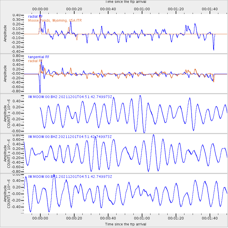
MOOW Moose Ponds, Wyoming, USA - Earthquake Result Viewer
*The percent match for this event was below the threshold and hence no stack was calculated.
| Earthquake location: |
Near Coast Of Central Chile |
| Earthquake latitude/longitude: |
-37.9/-73.6 |
| Earthquake time(UTC): |
2021/12/01 (335) 04:39:24 GMT |
| Earthquake Depth: |
13 km |
| Earthquake Magnitude: |
5.1 Mww |
| Earthquake Catalog/Contributor: |
NEIC PDE/us |
|
| Network: |
IW Intermountain West |
| Station: |
MOOW Moose Ponds, Wyoming, USA |
| Lat/Lon: |
43.75 N/110.74 W |
| Elevation: |
2128 m |
|
| Distance: |
88.0 deg |
| Az: |
334.027 deg |
| Baz: |
151.453 deg |
| Ray Param: |
$rayparam |
*The percent match for this event was below the threshold and hence was not used in the summary stack. |
|
| Radial Match: |
50.76274 % |
| Radial Bump: |
400 |
| Transverse Match: |
63.04807 % |
| Transverse Bump: |
400 |
| SOD ConfigId: |
26694651 |
| Insert Time: |
2021-12-15 04:47:03.969 +0000 |
| GWidth: |
2.5 |
| Max Bumps: |
400 |
| Tol: |
0.001 |
|
Signal To Noise
| Channel | StoN | STA | LTA |
| IW:MOOW:00:BHZ:20211201T04:51:42.749973Z | 0.5011611 | 1.2038339E-7 | 2.4020895E-7 |
| IW:MOOW:00:BH1:20211201T04:51:42.749973Z | 0.61926657 | 2.0023887E-7 | 3.2334842E-7 |
| IW:MOOW:00:BH2:20211201T04:51:42.749973Z | 1.1742978 | 2.7247717E-7 | 2.3203414E-7 |
| Arrivals |
| Ps | |
| PpPs | |
| PsPs/PpSs | |


