You are here: Home > Network List > US - United States National Seismic Network Stations List
> Station ERPA Erie, Pennsylvania, USA > Earthquake Result Viewer
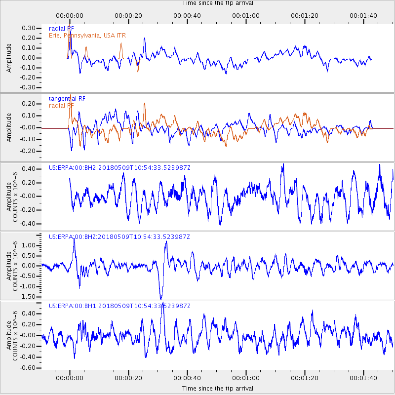
ERPA Erie, Pennsylvania, USA - Earthquake Result Viewer
*The percent match for this event was below the threshold and hence no stack was calculated.
| Earthquake location: |
Afghanistan-Tajikistan Bord Reg. |
| Earthquake latitude/longitude: |
37.0/71.4 |
| Earthquake time(UTC): |
2018/05/09 (129) 10:41:45 GMT |
| Earthquake Depth: |
112 km |
| Earthquake Magnitude: |
6.2 Mww |
| Earthquake Catalog/Contributor: |
NEIC PDE/us |
|
| Network: |
US United States National Seismic Network |
| Station: |
ERPA Erie, Pennsylvania, USA |
| Lat/Lon: |
42.12 N/79.99 W |
| Elevation: |
306 m |
|
| Distance: |
97.0 deg |
| Az: |
338.94 deg |
| Baz: |
22.75 deg |
| Ray Param: |
$rayparam |
*The percent match for this event was below the threshold and hence was not used in the summary stack. |
|
| Radial Match: |
56.6883 % |
| Radial Bump: |
400 |
| Transverse Match: |
55.662094 % |
| Transverse Bump: |
400 |
| SOD ConfigId: |
2665671 |
| Insert Time: |
2018-05-23 10:45:41.278 +0000 |
| GWidth: |
2.5 |
| Max Bumps: |
400 |
| Tol: |
0.001 |
|
Signal To Noise
| Channel | StoN | STA | LTA |
| US:ERPA:00:BHZ:20180509T10:54:33.523987Z | 4.2862625 | 5.2917414E-7 | 1.2345818E-7 |
| US:ERPA:00:BH1:20180509T10:54:33.523987Z | 2.0736294 | 1.614036E-7 | 7.783628E-8 |
| US:ERPA:00:BH2:20180509T10:54:33.523987Z | 0.83062893 | 1.2051869E-7 | 1.450933E-7 |
| Arrivals |
| Ps | |
| PpPs | |
| PsPs/PpSs | |


