You are here: Home > Network List > US - United States National Seismic Network Stations List
> Station GLMI Grayling, Michigan, USA > Earthquake Result Viewer
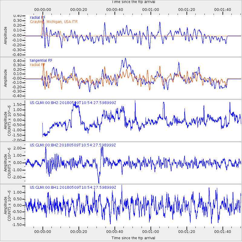
GLMI Grayling, Michigan, USA - Earthquake Result Viewer
*The percent match for this event was below the threshold and hence no stack was calculated.
| Earthquake location: |
Afghanistan-Tajikistan Bord Reg. |
| Earthquake latitude/longitude: |
37.0/71.4 |
| Earthquake time(UTC): |
2018/05/09 (129) 10:41:45 GMT |
| Earthquake Depth: |
112 km |
| Earthquake Magnitude: |
6.2 Mww |
| Earthquake Catalog/Contributor: |
NEIC PDE/us |
|
| Network: |
US United States National Seismic Network |
| Station: |
GLMI Grayling, Michigan, USA |
| Lat/Lon: |
44.82 N/84.62 W |
| Elevation: |
387 m |
|
| Distance: |
95.7 deg |
| Az: |
343.079 deg |
| Baz: |
19.115 deg |
| Ray Param: |
$rayparam |
*The percent match for this event was below the threshold and hence was not used in the summary stack. |
|
| Radial Match: |
45.109474 % |
| Radial Bump: |
400 |
| Transverse Match: |
33.14732 % |
| Transverse Bump: |
400 |
| SOD ConfigId: |
2665671 |
| Insert Time: |
2018-05-23 10:45:44.433 +0000 |
| GWidth: |
2.5 |
| Max Bumps: |
400 |
| Tol: |
0.001 |
|
Signal To Noise
| Channel | StoN | STA | LTA |
| US:GLMI:00:BHZ:20180509T10:54:27.598999Z | 3.8507397 | 8.8546415E-7 | 2.2994651E-7 |
| US:GLMI:00:BH1:20180509T10:54:27.598999Z | 1.171071 | 4.1369722E-7 | 3.5326397E-7 |
| US:GLMI:00:BH2:20180509T10:54:27.598999Z | 0.6733334 | 5.701165E-7 | 8.467076E-7 |
| Arrivals |
| Ps | |
| PpPs | |
| PsPs/PpSs | |


