You are here: Home > Network List > AZ - ANZA Regional Network Stations List
> Station SMER AZ.SMER > Earthquake Result Viewer
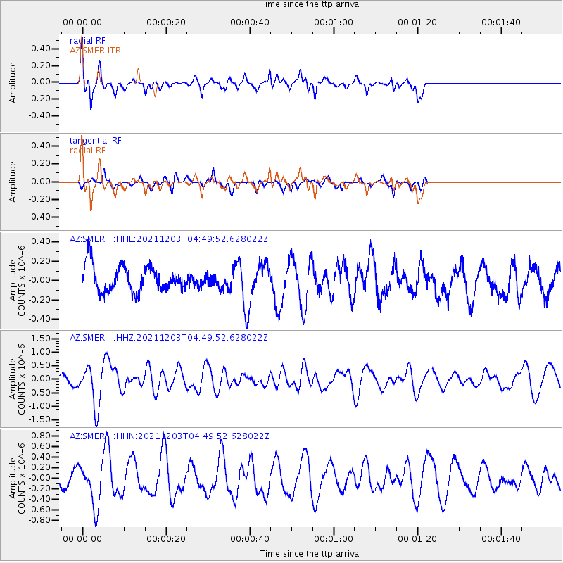
SMER AZ.SMER - Earthquake Result Viewer
*The percent match for this event was below the threshold and hence no stack was calculated.
| Earthquake location: |
Easter Island Region |
| Earthquake latitude/longitude: |
-28.6/-112.3 |
| Earthquake time(UTC): |
2021/12/03 (337) 04:40:04 GMT |
| Earthquake Depth: |
10 km |
| Earthquake Magnitude: |
6.2 mww |
| Earthquake Catalog/Contributor: |
NEIC PDE/us |
|
| Network: |
AZ ANZA Regional Network |
| Station: |
SMER AZ.SMER |
| Lat/Lon: |
33.46 N/117.17 W |
| Elevation: |
355 m |
|
| Distance: |
61.9 deg |
| Az: |
355.349 deg |
| Baz: |
175.109 deg |
| Ray Param: |
$rayparam |
*The percent match for this event was below the threshold and hence was not used in the summary stack. |
|
| Radial Match: |
75.390335 % |
| Radial Bump: |
347 |
| Transverse Match: |
73.14253 % |
| Transverse Bump: |
307 |
| SOD ConfigId: |
26694651 |
| Insert Time: |
2021-12-17 04:44:13.991 +0000 |
| GWidth: |
2.5 |
| Max Bumps: |
400 |
| Tol: |
0.001 |
|
Signal To Noise
| Channel | StoN | STA | LTA |
| AZ:SMER: :HHZ:20211203T04:49:52.628022Z | 4.25034 | 7.573763E-7 | 1.7819194E-7 |
| AZ:SMER: :HHN:20211203T04:49:52.628022Z | 1.5322639 | 4.0145946E-7 | 2.620041E-7 |
| AZ:SMER: :HHE:20211203T04:49:52.628022Z | 0.50931203 | 6.702167E-8 | 1.3159256E-7 |
| Arrivals |
| Ps | |
| PpPs | |
| PsPs/PpSs | |


