You are here: Home > Network List > US - United States National Seismic Network Stations List
> Station MSO Missoula, Montana, USA > Earthquake Result Viewer
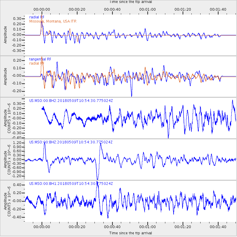
MSO Missoula, Montana, USA - Earthquake Result Viewer
*The percent match for this event was below the threshold and hence no stack was calculated.
| Earthquake location: |
Afghanistan-Tajikistan Bord Reg. |
| Earthquake latitude/longitude: |
37.0/71.4 |
| Earthquake time(UTC): |
2018/05/09 (129) 10:41:45 GMT |
| Earthquake Depth: |
112 km |
| Earthquake Magnitude: |
6.2 Mww |
| Earthquake Catalog/Contributor: |
NEIC PDE/us |
|
| Network: |
US United States National Seismic Network |
| Station: |
MSO Missoula, Montana, USA |
| Lat/Lon: |
46.83 N/113.94 W |
| Elevation: |
1264 m |
|
| Distance: |
96.4 deg |
| Az: |
3.666 deg |
| Baz: |
355.724 deg |
| Ray Param: |
$rayparam |
*The percent match for this event was below the threshold and hence was not used in the summary stack. |
|
| Radial Match: |
77.07205 % |
| Radial Bump: |
400 |
| Transverse Match: |
68.40537 % |
| Transverse Bump: |
400 |
| SOD ConfigId: |
2665671 |
| Insert Time: |
2018-05-23 10:45:51.335 +0000 |
| GWidth: |
2.5 |
| Max Bumps: |
400 |
| Tol: |
0.001 |
|
Signal To Noise
| Channel | StoN | STA | LTA |
| US:MSO:00:BHZ:20180509T10:54:30.775024Z | 10.619612 | 5.710047E-7 | 5.3768886E-8 |
| US:MSO:00:BH1:20180509T10:54:30.775024Z | 3.0202425 | 1.5626838E-7 | 5.1740347E-8 |
| US:MSO:00:BH2:20180509T10:54:30.775024Z | 0.45421883 | 4.6569976E-8 | 1.02527615E-7 |
| Arrivals |
| Ps | |
| PpPs | |
| PsPs/PpSs | |


