You are here: Home > Network List > CI - Caltech Regional Seismic Network Stations List
> Station SMM Simmler, CA, USA > Earthquake Result Viewer
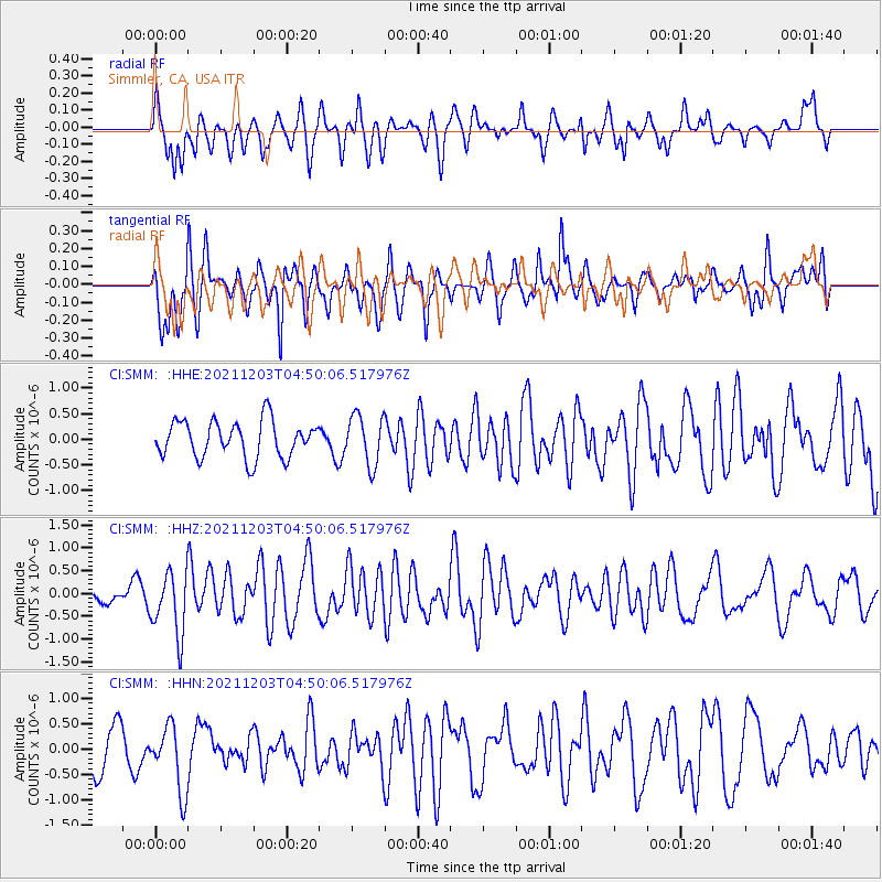
SMM Simmler, CA, USA - Earthquake Result Viewer
*The percent match for this event was below the threshold and hence no stack was calculated.
| Earthquake location: |
Easter Island Region |
| Earthquake latitude/longitude: |
-28.6/-112.3 |
| Earthquake time(UTC): |
2021/12/03 (337) 04:40:04 GMT |
| Earthquake Depth: |
10 km |
| Earthquake Magnitude: |
6.2 mww |
| Earthquake Catalog/Contributor: |
NEIC PDE/us |
|
| Network: |
CI Caltech Regional Seismic Network |
| Station: |
SMM Simmler, CA, USA |
| Lat/Lon: |
35.31 N/120.00 W |
| Elevation: |
599 m |
|
| Distance: |
64.0 deg |
| Az: |
352.967 deg |
| Baz: |
172.437 deg |
| Ray Param: |
$rayparam |
*The percent match for this event was below the threshold and hence was not used in the summary stack. |
|
| Radial Match: |
55.363304 % |
| Radial Bump: |
352 |
| Transverse Match: |
74.75402 % |
| Transverse Bump: |
400 |
| SOD ConfigId: |
26694651 |
| Insert Time: |
2021-12-17 04:48:10.440 +0000 |
| GWidth: |
2.5 |
| Max Bumps: |
400 |
| Tol: |
0.001 |
|
Signal To Noise
| Channel | StoN | STA | LTA |
| CI:SMM: :HHZ:20211203T04:50:06.517976Z | 4.509014 | 6.990749E-7 | 1.5503942E-7 |
| CI:SMM: :HHN:20211203T04:50:06.517976Z | 1.727801 | 6.512481E-7 | 3.769231E-7 |
| CI:SMM: :HHE:20211203T04:50:06.517976Z | 1.3627564 | 4.850383E-7 | 3.559244E-7 |
| Arrivals |
| Ps | |
| PpPs | |
| PsPs/PpSs | |


