SSAN YL.SSAN - Earthquake Result Viewer
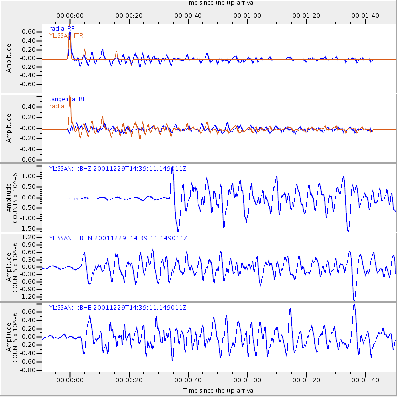
Earthquake location: Southwest Of Sumatra, Indonesia
Earthquake latitude/longitude: -6.0/102.8
Earthquake time(UTC): 2001/12/29 (363) 14:32:22 GMT
Earthquake Depth: 33 km
Earthquake Magnitude: 5.6 MB, 5.7 MS, 5.8 MW, 5.6 MW
Earthquake Catalog/Contributor: WHDF/NEIC
Network: YL Himalayan Nepal Tibet Experiment
Station: SSAN YL.SSAN
Lat/Lon: 29.42 N/86.73 E
Elevation: 4585 m
Distance: 38.5 deg
Az: 337.094 deg
Baz: 153.659 deg
Ray Param: 0.07546941
Estimated Moho Depth: 46.0 km
Estimated Crust Vp/Vs: 2.01
Assumed Crust Vp: 6.514 km/s
Estimated Crust Vs: 3.249 km/s
Estimated Crust Poisson's Ratio: 0.33
Radial Match: 85.109344 %
Radial Bump: 400
Transverse Match: 70.201195 %
Transverse Bump: 400
SOD ConfigId: 16820
Insert Time: 2010-02-26 16:12:53.749 +0000
GWidth: 2.5
Max Bumps: 400
Tol: 0.001

Signal To Noise

ChannelStoNSTALTA
YL:SSAN: :BHN:20011229T14:39:11.149011Z3.76181221.8520537E-74.9233016E-8
YL:SSAN: :BHE:20011229T14:39:11.149011Z2.63605621.14701834E-74.3512667E-8
YL:SSAN: :BHZ:20011229T14:39:11.149011Z10.9859924.824381E-74.3913936E-8
Arrivals
Ps7.6 SECOND
PpPs20 SECOND
PsPs/PpSs27 SECOND