SSAN YL.SSAN - Earthquake Result Viewer
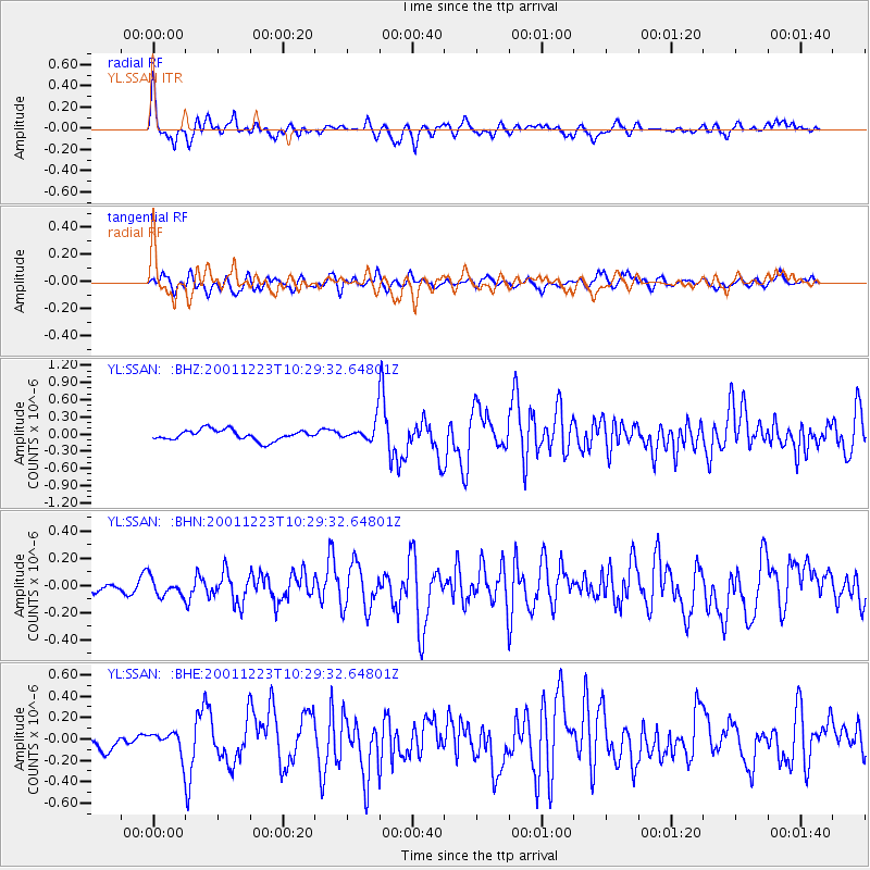
Earthquake location: Bonin Islands, Japan Region
Earthquake latitude/longitude: 27.9/141.8
Earthquake time(UTC): 2001/12/23 (357) 10:21:28 GMT
Earthquake Depth: 35 km
Earthquake Magnitude: 5.7 MB, 5.6 MS, 5.9 MW, 5.8 MW
Earthquake Catalog/Contributor: WHDF/NEIC
Network: YL Himalayan Nepal Tibet Experiment
Station: SSAN YL.SSAN
Lat/Lon: 29.42 N/86.73 E
Elevation: 4585 m
Distance: 47.9 deg
Az: 285.64 deg
Baz: 77.739 deg
Ray Param: 0.06961126
Estimated Moho Depth: 64.25 km
Estimated Crust Vp/Vs: 2.10
Assumed Crust Vp: 6.514 km/s
Estimated Crust Vs: 3.106 km/s
Estimated Crust Poisson's Ratio: 0.35
Radial Match: 81.350685 %
Radial Bump: 400
Transverse Match: 65.33598 %
Transverse Bump: 400
SOD ConfigId: 16820
Insert Time: 2010-02-26 16:12:58.263 +0000
GWidth: 2.5
Max Bumps: 400
Tol: 0.001

Signal To Noise

ChannelStoNSTALTA
YL:SSAN: :BHN:20011223T10:29:32.64801Z1.13262936.696559E-85.9124016E-8
YL:SSAN: :BHE:20011223T10:29:32.64801Z1.19457221.03115276E-78.631983E-8
YL:SSAN: :BHZ:20011223T10:29:32.64801Z1.90230771.718112E-79.031724E-8
Arrivals
Ps11 SECOND
PpPs29 SECOND
PsPs/PpSs40 SECOND