You are here: Home > Network List > US - United States National Seismic Network Stations List
> Station WUAZ Wupatki, Arizona, USA > Earthquake Result Viewer
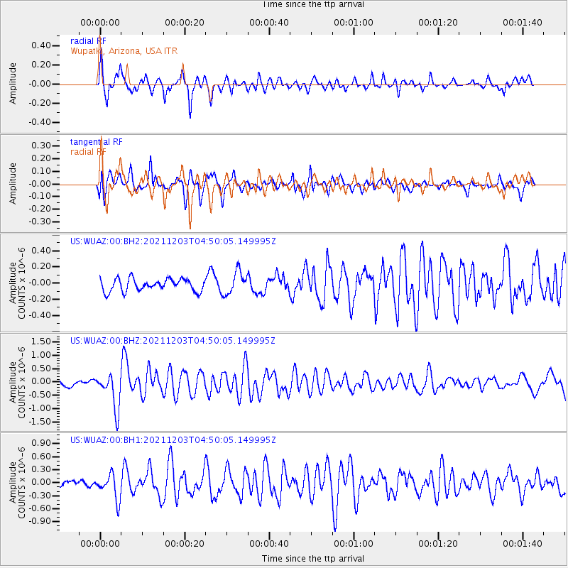
WUAZ Wupatki, Arizona, USA - Earthquake Result Viewer
*The percent match for this event was below the threshold and hence no stack was calculated.
| Earthquake location: |
Easter Island Region |
| Earthquake latitude/longitude: |
-28.6/-112.3 |
| Earthquake time(UTC): |
2021/12/03 (337) 04:40:04 GMT |
| Earthquake Depth: |
10 km |
| Earthquake Magnitude: |
6.2 mww |
| Earthquake Catalog/Contributor: |
NEIC PDE/us |
|
| Network: |
US United States National Seismic Network |
| Station: |
WUAZ Wupatki, Arizona, USA |
| Lat/Lon: |
35.52 N/111.37 W |
| Elevation: |
1592 m |
|
| Distance: |
63.8 deg |
| Az: |
0.807 deg |
| Baz: |
180.869 deg |
| Ray Param: |
$rayparam |
*The percent match for this event was below the threshold and hence was not used in the summary stack. |
|
| Radial Match: |
79.01484 % |
| Radial Bump: |
400 |
| Transverse Match: |
70.39278 % |
| Transverse Bump: |
400 |
| SOD ConfigId: |
26694651 |
| Insert Time: |
2021-12-17 05:05:40.712 +0000 |
| GWidth: |
2.5 |
| Max Bumps: |
400 |
| Tol: |
0.001 |
|
Signal To Noise
| Channel | StoN | STA | LTA |
| US:WUAZ:00:BHZ:20211203T04:50:05.149995Z | 5.308292 | 6.8421457E-7 | 1.2889544E-7 |
| US:WUAZ:00:BH1:20211203T04:50:05.149995Z | 2.416923 | 3.0118096E-7 | 1.246134E-7 |
| US:WUAZ:00:BH2:20211203T04:50:05.149995Z | 1.88762 | 1.4317983E-7 | 7.585204E-8 |
| Arrivals |
| Ps | |
| PpPs | |
| PsPs/PpSs | |


