You are here: Home > Network List > IW - Intermountain West Stations List
> Station MOOW Moose Ponds, Wyoming, USA > Earthquake Result Viewer
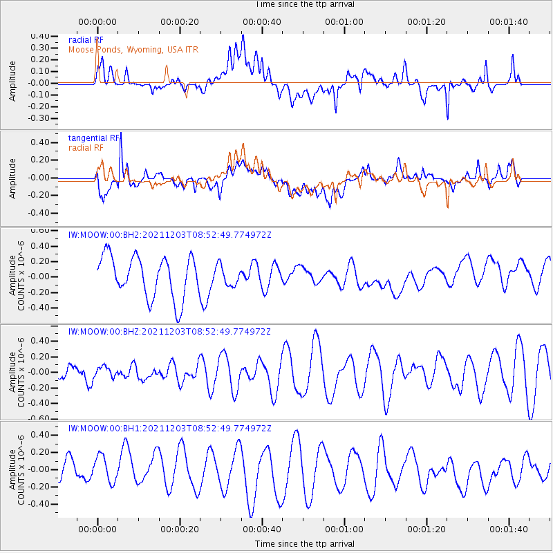
MOOW Moose Ponds, Wyoming, USA - Earthquake Result Viewer
*The percent match for this event was below the threshold and hence no stack was calculated.
| Earthquake location: |
Tonga Islands Region |
| Earthquake latitude/longitude: |
-23.5/-175.0 |
| Earthquake time(UTC): |
2021/12/03 (337) 08:40:26 GMT |
| Earthquake Depth: |
10 km |
| Earthquake Magnitude: |
5.5 Mww |
| Earthquake Catalog/Contributor: |
NEIC PDE/us |
|
| Network: |
IW Intermountain West |
| Station: |
MOOW Moose Ponds, Wyoming, USA |
| Lat/Lon: |
43.75 N/110.74 W |
| Elevation: |
2128 m |
|
| Distance: |
89.1 deg |
| Az: |
40.759 deg |
| Baz: |
235.815 deg |
| Ray Param: |
$rayparam |
*The percent match for this event was below the threshold and hence was not used in the summary stack. |
|
| Radial Match: |
31.046291 % |
| Radial Bump: |
400 |
| Transverse Match: |
54.07199 % |
| Transverse Bump: |
400 |
| SOD ConfigId: |
26694651 |
| Insert Time: |
2021-12-17 08:50:11.123 +0000 |
| GWidth: |
2.5 |
| Max Bumps: |
400 |
| Tol: |
0.001 |
|
Signal To Noise
| Channel | StoN | STA | LTA |
| IW:MOOW:00:BHZ:20211203T08:52:49.774972Z | 0.66677666 | 6.6979986E-8 | 1.0045341E-7 |
| IW:MOOW:00:BH1:20211203T08:52:49.774972Z | 1.0076284 | 1.9874173E-7 | 1.9723713E-7 |
| IW:MOOW:00:BH2:20211203T08:52:49.774972Z | 0.48935544 | 1.3061639E-7 | 2.6691515E-7 |
| Arrivals |
| Ps | |
| PpPs | |
| PsPs/PpSs | |


