You are here: Home > Network List > GS - US Geological Survey Networks Stations List
> Station KAN13 Rinehart Farm > Earthquake Result Viewer
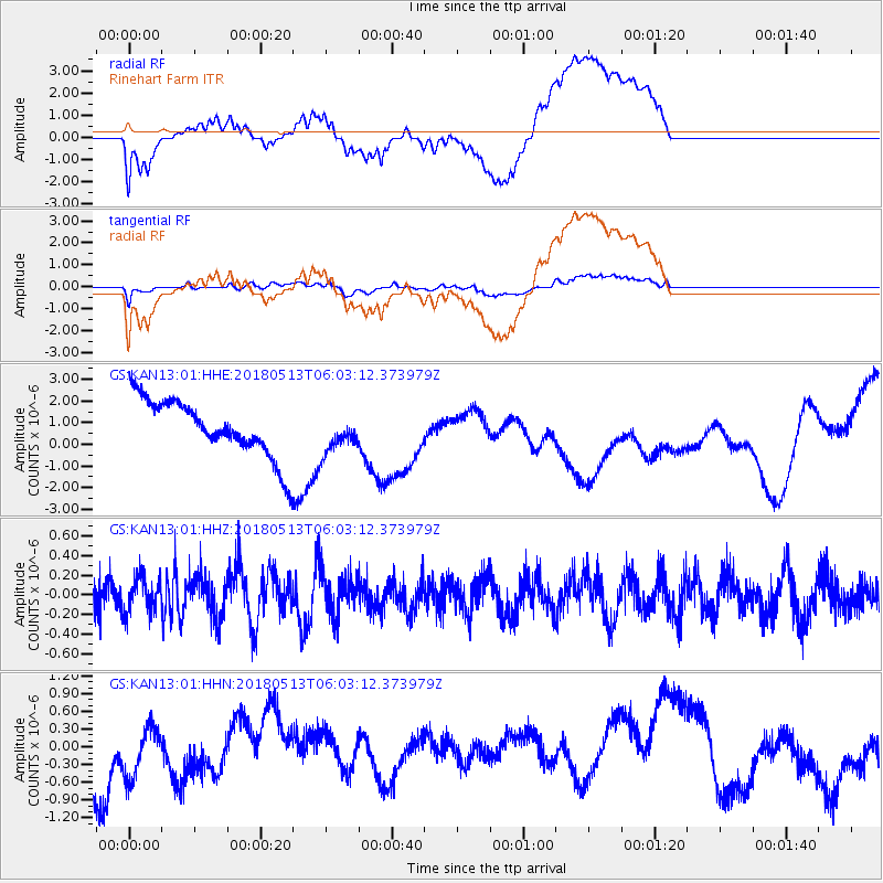
KAN13 Rinehart Farm - Earthquake Result Viewer
*The percent match for this event was below the threshold and hence no stack was calculated.
| Earthquake location: |
Tonga Islands |
| Earthquake latitude/longitude: |
-21.2/-173.9 |
| Earthquake time(UTC): |
2018/05/13 (133) 05:50:33 GMT |
| Earthquake Depth: |
10 km |
| Earthquake Magnitude: |
5.6 mb |
| Earthquake Catalog/Contributor: |
NEIC PDE/us |
|
| Network: |
GS US Geological Survey Networks |
| Station: |
KAN13 Rinehart Farm |
| Lat/Lon: |
37.01 N/97.48 W |
| Elevation: |
340 m |
|
| Distance: |
92.3 deg |
| Az: |
51.131 deg |
| Baz: |
245.215 deg |
| Ray Param: |
$rayparam |
*The percent match for this event was below the threshold and hence was not used in the summary stack. |
|
| Radial Match: |
29.219366 % |
| Radial Bump: |
400 |
| Transverse Match: |
27.861883 % |
| Transverse Bump: |
400 |
| SOD ConfigId: |
2665671 |
| Insert Time: |
2018-05-27 05:56:10.517 +0000 |
| GWidth: |
2.5 |
| Max Bumps: |
400 |
| Tol: |
0.001 |
|
Signal To Noise
| Channel | StoN | STA | LTA |
| GS:KAN13:01:HHZ:20180513T06:03:12.373979Z | 0.89401335 | 1.7649354E-7 | 1.9741712E-7 |
| GS:KAN13:01:HHN:20180513T06:03:12.373979Z | 1.5373813 | 5.1040547E-7 | 3.319967E-7 |
| GS:KAN13:01:HHE:20180513T06:03:12.373979Z | 0.69521815 | 9.1039215E-7 | 1.3095057E-6 |
| Arrivals |
| Ps | |
| PpPs | |
| PsPs/PpSs | |


