You are here: Home > Network List > US - United States National Seismic Network Stations List
> Station HAWA Hanford, Washington, USA > Earthquake Result Viewer
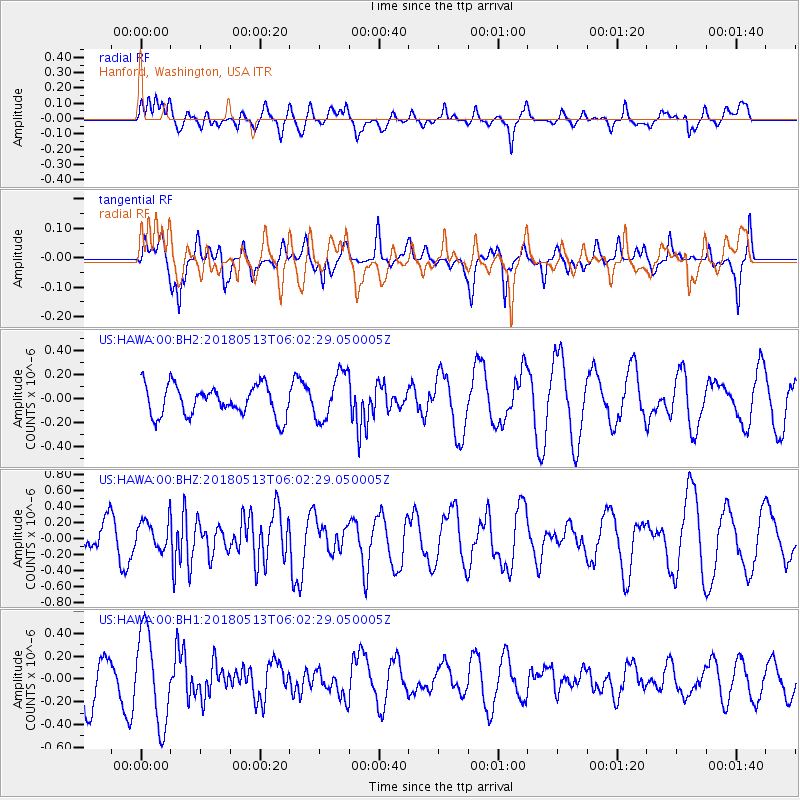
HAWA Hanford, Washington, USA - Earthquake Result Viewer
*The percent match for this event was below the threshold and hence no stack was calculated.
| Earthquake location: |
Tonga Islands |
| Earthquake latitude/longitude: |
-21.2/-173.9 |
| Earthquake time(UTC): |
2018/05/13 (133) 05:50:33 GMT |
| Earthquake Depth: |
10 km |
| Earthquake Magnitude: |
5.6 mb |
| Earthquake Catalog/Contributor: |
NEIC PDE/us |
|
| Network: |
US United States National Seismic Network |
| Station: |
HAWA Hanford, Washington, USA |
| Lat/Lon: |
46.39 N/119.53 W |
| Elevation: |
364 m |
|
| Distance: |
83.2 deg |
| Az: |
34.492 deg |
| Baz: |
229.788 deg |
| Ray Param: |
$rayparam |
*The percent match for this event was below the threshold and hence was not used in the summary stack. |
|
| Radial Match: |
51.276886 % |
| Radial Bump: |
400 |
| Transverse Match: |
49.829605 % |
| Transverse Bump: |
331 |
| SOD ConfigId: |
2665671 |
| Insert Time: |
2018-05-27 05:58:11.978 +0000 |
| GWidth: |
2.5 |
| Max Bumps: |
400 |
| Tol: |
0.001 |
|
Signal To Noise
| Channel | StoN | STA | LTA |
| US:HAWA:00:BHZ:20180513T06:02:29.050005Z | 0.5672709 | 1.8795939E-7 | 3.3133975E-7 |
| US:HAWA:00:BH1:20180513T06:02:29.050005Z | 1.8317326 | 4.026263E-7 | 2.1980627E-7 |
| US:HAWA:00:BH2:20180513T06:02:29.050005Z | 1.5552702 | 1.9520773E-7 | 1.2551371E-7 |
| Arrivals |
| Ps | |
| PpPs | |
| PsPs/PpSs | |


