You are here: Home > Network List > AZ - ANZA Regional Network Stations List
> Station SMER AZ.SMER > Earthquake Result Viewer
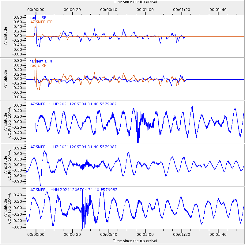
SMER AZ.SMER - Earthquake Result Viewer
*The percent match for this event was below the threshold and hence no stack was calculated.
| Earthquake location: |
Kermadec Islands Region |
| Earthquake latitude/longitude: |
-28.9/-175.9 |
| Earthquake time(UTC): |
2021/12/06 (340) 04:19:45 GMT |
| Earthquake Depth: |
10 km |
| Earthquake Magnitude: |
5.6 Mww |
| Earthquake Catalog/Contributor: |
NEIC PDE/us |
|
| Network: |
AZ ANZA Regional Network |
| Station: |
SMER AZ.SMER |
| Lat/Lon: |
33.46 N/117.17 W |
| Elevation: |
355 m |
|
| Distance: |
83.3 deg |
| Az: |
45.994 deg |
| Baz: |
228.95 deg |
| Ray Param: |
$rayparam |
*The percent match for this event was below the threshold and hence was not used in the summary stack. |
|
| Radial Match: |
55.509884 % |
| Radial Bump: |
400 |
| Transverse Match: |
47.250732 % |
| Transverse Bump: |
400 |
| SOD ConfigId: |
26694651 |
| Insert Time: |
2021-12-20 04:27:15.079 +0000 |
| GWidth: |
2.5 |
| Max Bumps: |
400 |
| Tol: |
0.001 |
|
Signal To Noise
| Channel | StoN | STA | LTA |
| AZ:SMER: :HHZ:20211206T04:31:40.557998Z | 2.088571 | 5.371233E-7 | 2.5717262E-7 |
| AZ:SMER: :HHN:20211206T04:31:40.557998Z | 0.7704589 | 1.9967666E-7 | 2.591659E-7 |
| AZ:SMER: :HHE:20211206T04:31:40.557998Z | 1.2647374 | 2.9126755E-7 | 2.3029884E-7 |
| Arrivals |
| Ps | |
| PpPs | |
| PsPs/PpSs | |


