You are here: Home > Network List > IW - Intermountain West Stations List
> Station MOOW Moose Ponds, Wyoming, USA > Earthquake Result Viewer
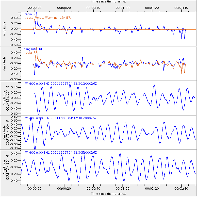
MOOW Moose Ponds, Wyoming, USA - Earthquake Result Viewer
*The percent match for this event was below the threshold and hence no stack was calculated.
| Earthquake location: |
Kermadec Islands Region |
| Earthquake latitude/longitude: |
-28.9/-175.9 |
| Earthquake time(UTC): |
2021/12/06 (340) 04:19:45 GMT |
| Earthquake Depth: |
10 km |
| Earthquake Magnitude: |
5.6 Mww |
| Earthquake Catalog/Contributor: |
NEIC PDE/us |
|
| Network: |
IW Intermountain West |
| Station: |
MOOW Moose Ponds, Wyoming, USA |
| Lat/Lon: |
43.75 N/110.74 W |
| Elevation: |
2128 m |
|
| Distance: |
93.7 deg |
| Az: |
41.214 deg |
| Baz: |
232.837 deg |
| Ray Param: |
$rayparam |
*The percent match for this event was below the threshold and hence was not used in the summary stack. |
|
| Radial Match: |
63.62492 % |
| Radial Bump: |
400 |
| Transverse Match: |
54.942635 % |
| Transverse Bump: |
400 |
| SOD ConfigId: |
26694651 |
| Insert Time: |
2021-12-20 04:37:32.171 +0000 |
| GWidth: |
2.5 |
| Max Bumps: |
400 |
| Tol: |
0.001 |
|
Signal To Noise
| Channel | StoN | STA | LTA |
| IW:MOOW:00:BHZ:20211206T04:32:30.200026Z | 2.0195997 | 5.2191746E-7 | 2.5842618E-7 |
| IW:MOOW:00:BH1:20211206T04:32:30.200026Z | 0.7437618 | 1.7213482E-7 | 2.3143811E-7 |
| IW:MOOW:00:BH2:20211206T04:32:30.200026Z | 0.977792 | 2.913602E-7 | 2.979777E-7 |
| Arrivals |
| Ps | |
| PpPs | |
| PsPs/PpSs | |


