You are here: Home > Network List > UW - Pacific Northwest Regional Seismic Network Stations List
> Station IRON Crane, OR, USA > Earthquake Result Viewer
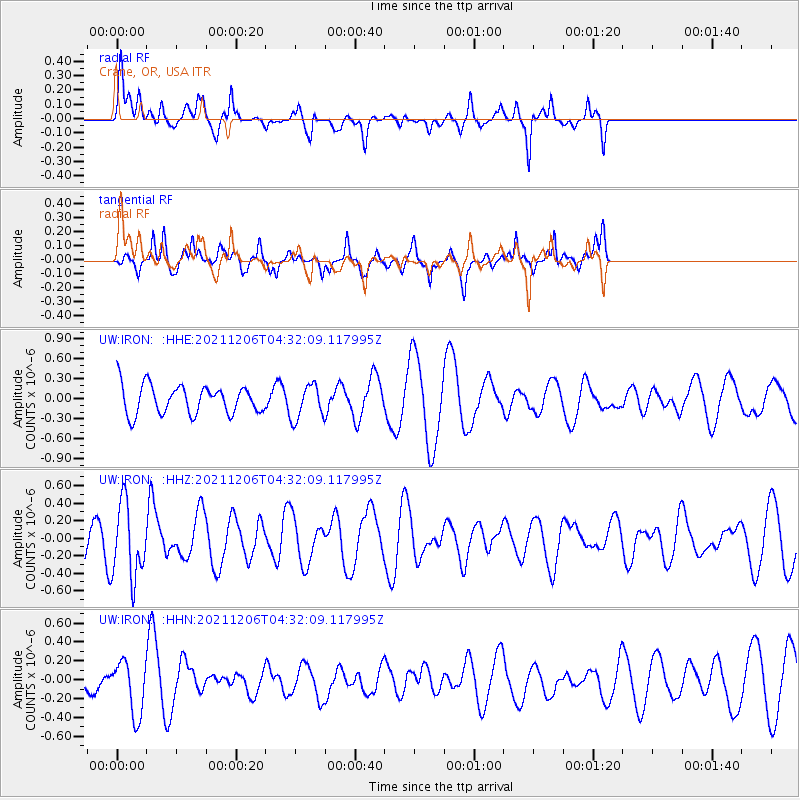
IRON Crane, OR, USA - Earthquake Result Viewer
*The percent match for this event was below the threshold and hence no stack was calculated.
| Earthquake location: |
Kermadec Islands Region |
| Earthquake latitude/longitude: |
-28.9/-175.9 |
| Earthquake time(UTC): |
2021/12/06 (340) 04:19:45 GMT |
| Earthquake Depth: |
10 km |
| Earthquake Magnitude: |
5.6 Mww |
| Earthquake Catalog/Contributor: |
NEIC PDE/us |
|
| Network: |
UW Pacific Northwest Regional Seismic Network |
| Station: |
IRON Crane, OR, USA |
| Lat/Lon: |
43.36 N/118.47 W |
| Elevation: |
1226 m |
|
| Distance: |
89.1 deg |
| Az: |
37.92 deg |
| Baz: |
227.607 deg |
| Ray Param: |
$rayparam |
*The percent match for this event was below the threshold and hence was not used in the summary stack. |
|
| Radial Match: |
51.783653 % |
| Radial Bump: |
332 |
| Transverse Match: |
45.71761 % |
| Transverse Bump: |
310 |
| SOD ConfigId: |
26694651 |
| Insert Time: |
2021-12-20 04:49:49.031 +0000 |
| GWidth: |
2.5 |
| Max Bumps: |
400 |
| Tol: |
0.001 |
|
Signal To Noise
| Channel | StoN | STA | LTA |
| UW:IRON: :HHZ:20211206T04:32:09.117995Z | 1.5808439 | 4.262669E-7 | 2.6964514E-7 |
| UW:IRON: :HHN:20211206T04:32:09.117995Z | 2.0016322 | 2.8560981E-7 | 1.4268846E-7 |
| UW:IRON: :HHE:20211206T04:32:09.117995Z | 1.197184 | 2.589419E-7 | 2.162925E-7 |
| Arrivals |
| Ps | |
| PpPs | |
| PsPs/PpSs | |


