You are here: Home > Network List > CI - Caltech Regional Seismic Network Stations List
> Station CWC Cottonwood Creek, Lone Pine, CA, USA > Earthquake Result Viewer
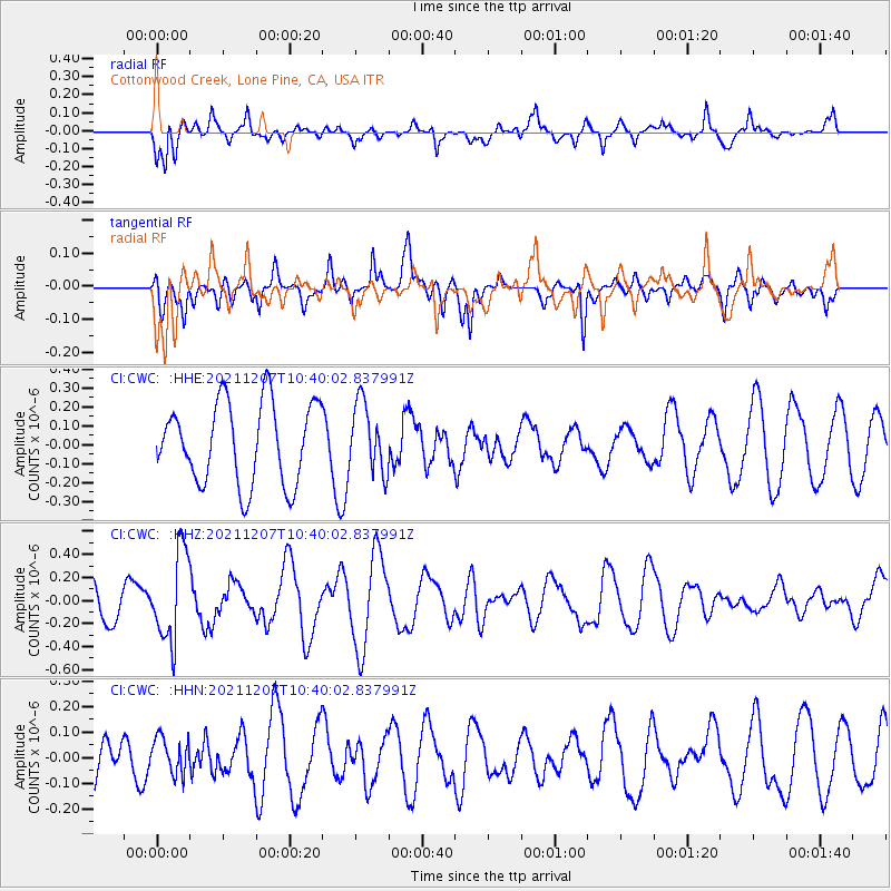
CWC Cottonwood Creek, Lone Pine, CA, USA - Earthquake Result Viewer
*The percent match for this event was below the threshold and hence no stack was calculated.
| Earthquake location: |
Solomon Islands |
| Earthquake latitude/longitude: |
-10.0/161.0 |
| Earthquake time(UTC): |
2021/12/07 (341) 10:28:00 GMT |
| Earthquake Depth: |
170 km |
| Earthquake Magnitude: |
5.4 Mww |
| Earthquake Catalog/Contributor: |
NEIC PDE/us |
|
| Network: |
CI Caltech Regional Seismic Network |
| Station: |
CWC Cottonwood Creek, Lone Pine, CA, USA |
| Lat/Lon: |
36.44 N/118.08 W |
| Elevation: |
1595 m |
|
| Distance: |
88.6 deg |
| Az: |
52.789 deg |
| Baz: |
256.641 deg |
| Ray Param: |
$rayparam |
*The percent match for this event was below the threshold and hence was not used in the summary stack. |
|
| Radial Match: |
47.13769 % |
| Radial Bump: |
400 |
| Transverse Match: |
59.133945 % |
| Transverse Bump: |
400 |
| SOD ConfigId: |
26694651 |
| Insert Time: |
2021-12-21 10:34:36.213 +0000 |
| GWidth: |
2.5 |
| Max Bumps: |
400 |
| Tol: |
0.001 |
|
Signal To Noise
| Channel | StoN | STA | LTA |
| CI:CWC: :HHZ:20211207T10:40:02.837991Z | 2.203812 | 3.8574083E-7 | 1.7503346E-7 |
| CI:CWC: :HHN:20211207T10:40:02.837991Z | 0.902917 | 6.9558126E-8 | 7.7037114E-8 |
| CI:CWC: :HHE:20211207T10:40:02.837991Z | 0.85860056 | 1.8324694E-7 | 2.1342514E-7 |
| Arrivals |
| Ps | |
| PpPs | |
| PsPs/PpSs | |


