SSAN YL.SSAN - Earthquake Result Viewer
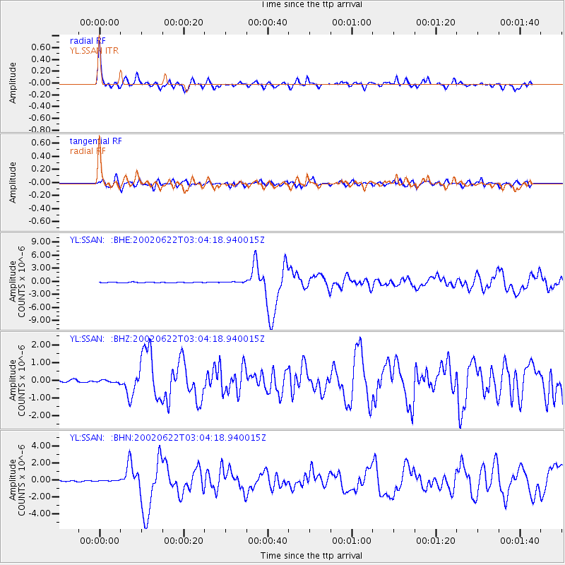
Earthquake location: Western Iran
Earthquake latitude/longitude: 35.6/49.0
Earthquake time(UTC): 2002/06/22 (173) 02:58:21 GMT
Earthquake Depth: 10 km
Earthquake Magnitude: 6.2 MB, 6.4 MS, 6.5 MW, 6.5 MW
Earthquake Catalog/Contributor: WHDF/NEIC
Network: YL Himalayan Nepal Tibet Experiment
Station: SSAN YL.SSAN
Lat/Lon: 29.42 N/86.73 E
Elevation: 4585 m
Distance: 32.2 deg
Az: 90.237 deg
Baz: 290.962 deg
Ray Param: 0.07874093
Estimated Moho Depth: 50.5 km
Estimated Crust Vp/Vs: 2.09
Assumed Crust Vp: 6.514 km/s
Estimated Crust Vs: 3.121 km/s
Estimated Crust Poisson's Ratio: 0.35
Radial Match: 88.96002 %
Radial Bump: 400
Transverse Match: 69.247086 %
Transverse Bump: 400
SOD ConfigId: 16820
Insert Time: 2010-02-26 16:13:29.974 +0000
GWidth: 2.5
Max Bumps: 400
Tol: 0.001

Signal To Noise

ChannelStoNSTALTA
YL:SSAN: :BHZ:20020622T03:04:18.940015Z1.17603717.240561E-86.1567455E-8
YL:SSAN: :BHN:20020622T03:04:18.940015Z1.43834157.028761E-84.886712E-8
YL:SSAN: :BHE:20020622T03:04:18.940015Z1.40953331.0924449E-77.750401E-8
Arrivals
Ps9.0 SECOND
PpPs22 SECOND
PsPs/PpSs31 SECOND