You are here: Home > Network List > GS - US Geological Survey Networks Stations List
> Station DEC06 Boomer > Earthquake Result Viewer
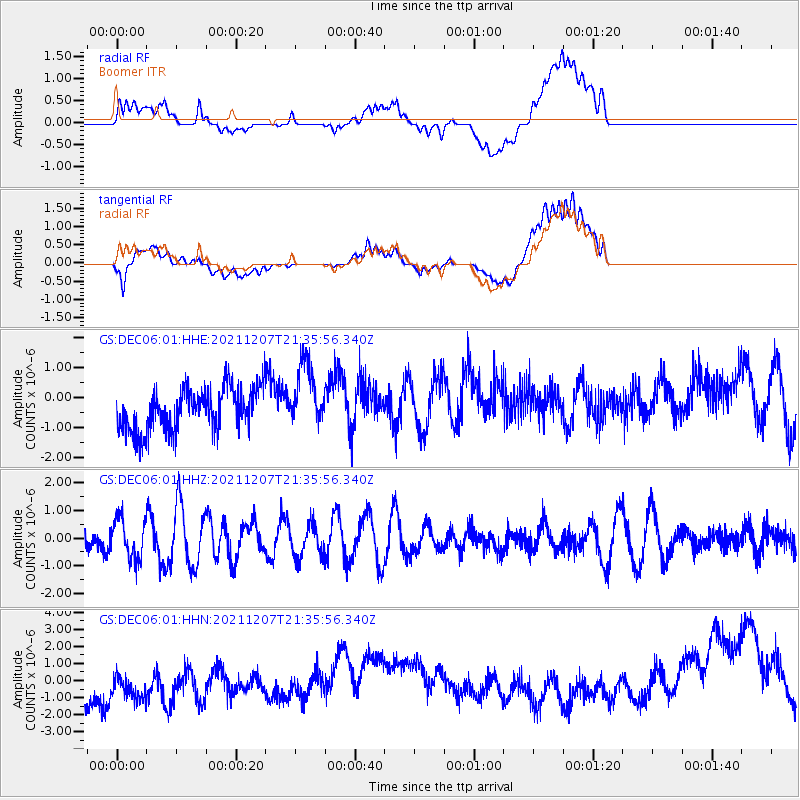
DEC06 Boomer - Earthquake Result Viewer
*The percent match for this event was below the threshold and hence no stack was calculated.
| Earthquake location: |
Off Coast Of Oregon |
| Earthquake latitude/longitude: |
44.4/-129.5 |
| Earthquake time(UTC): |
2021/12/07 (341) 21:30:16 GMT |
| Earthquake Depth: |
10 km |
| Earthquake Magnitude: |
5.5 mww |
| Earthquake Catalog/Contributor: |
NEIC PDE/us |
|
| Network: |
GS US Geological Survey Networks |
| Station: |
DEC06 Boomer |
| Lat/Lon: |
39.90 N/88.95 W |
| Elevation: |
215 m |
|
| Distance: |
30.2 deg |
| Az: |
84.258 deg |
| Baz: |
292.005 deg |
| Ray Param: |
$rayparam |
*The percent match for this event was below the threshold and hence was not used in the summary stack. |
|
| Radial Match: |
51.453976 % |
| Radial Bump: |
400 |
| Transverse Match: |
45.55361 % |
| Transverse Bump: |
400 |
| SOD ConfigId: |
26694651 |
| Insert Time: |
2021-12-21 21:33:55.849 +0000 |
| GWidth: |
2.5 |
| Max Bumps: |
400 |
| Tol: |
0.001 |
|
Signal To Noise
| Channel | StoN | STA | LTA |
| GS:DEC06:01:HHZ:20211207T21:35:56.340Z | 1.9610019 | 7.1717466E-7 | 3.6571848E-7 |
| GS:DEC06:01:HHN:20211207T21:35:56.340Z | 1.0749094 | 2.1355838E-6 | 1.986757E-6 |
| GS:DEC06:01:HHE:20211207T21:35:56.340Z | 1.5439479 | 1.0804646E-6 | 6.998063E-7 |
| Arrivals |
| Ps | |
| PpPs | |
| PsPs/PpSs | |


