You are here: Home > Network List > CI - Caltech Regional Seismic Network Stations List
> Station MPP McPhearson Peak > Earthquake Result Viewer
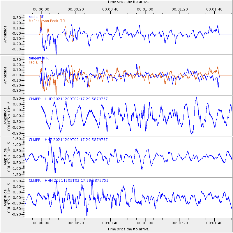
MPP McPhearson Peak - Earthquake Result Viewer
*The percent match for this event was below the threshold and hence no stack was calculated.
| Earthquake location: |
Ryukyu Islands, Japan |
| Earthquake latitude/longitude: |
29.4/129.4 |
| Earthquake time(UTC): |
2021/12/09 (343) 02:05:07 GMT |
| Earthquake Depth: |
10 km |
| Earthquake Magnitude: |
5.9 Mww |
| Earthquake Catalog/Contributor: |
NEIC PDE/us |
|
| Network: |
CI Caltech Regional Seismic Network |
| Station: |
MPP McPhearson Peak |
| Lat/Lon: |
34.89 N/119.81 W |
| Elevation: |
1739 m |
|
| Distance: |
88.6 deg |
| Az: |
50.244 deg |
| Baz: |
305.314 deg |
| Ray Param: |
$rayparam |
*The percent match for this event was below the threshold and hence was not used in the summary stack. |
|
| Radial Match: |
63.83755 % |
| Radial Bump: |
400 |
| Transverse Match: |
45.73131 % |
| Transverse Bump: |
400 |
| SOD ConfigId: |
26694651 |
| Insert Time: |
2021-12-23 02:15:57.905 +0000 |
| GWidth: |
2.5 |
| Max Bumps: |
400 |
| Tol: |
0.001 |
|
Signal To Noise
| Channel | StoN | STA | LTA |
| CI:MPP: :HHZ:20211209T02:17:29.587975Z | 3.013255 | 5.42671E-7 | 1.8009462E-7 |
| CI:MPP: :HHN:20211209T02:17:29.587975Z | 0.61385715 | 1.2893896E-7 | 2.1004716E-7 |
| CI:MPP: :HHE:20211209T02:17:29.587975Z | 0.7383231 | 3.0387977E-7 | 4.11581E-7 |
| Arrivals |
| Ps | |
| PpPs | |
| PsPs/PpSs | |


