You are here: Home > Network List > IU - Global Seismograph Network (GSN - IRIS/USGS) Stations List
> Station CCM Cathedral Cave, Missouri, USA > Earthquake Result Viewer
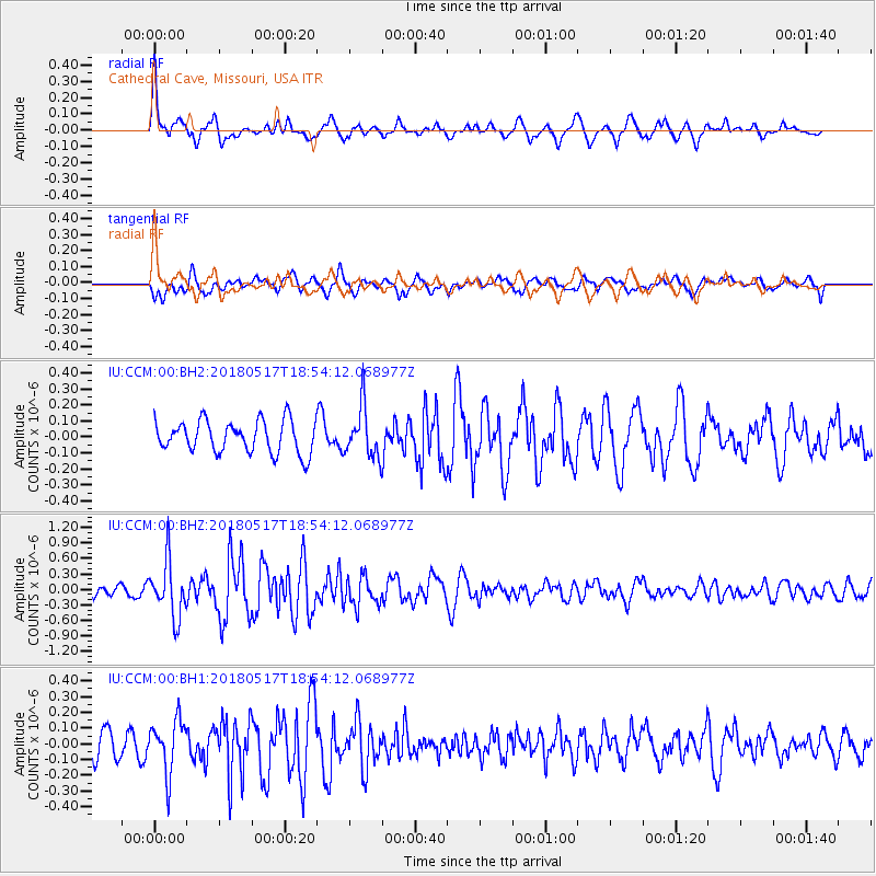
CCM Cathedral Cave, Missouri, USA - Earthquake Result Viewer
*The percent match for this event was below the threshold and hence no stack was calculated.
| Earthquake location: |
Hokkaido, Japan Region |
| Earthquake latitude/longitude: |
42.7/145.6 |
| Earthquake time(UTC): |
2018/05/17 (137) 18:42:10 GMT |
| Earthquake Depth: |
10 km |
| Earthquake Magnitude: |
5.8 Mww |
| Earthquake Catalog/Contributor: |
NEIC PDE/us |
|
| Network: |
IU Global Seismograph Network (GSN - IRIS/USGS) |
| Station: |
CCM Cathedral Cave, Missouri, USA |
| Lat/Lon: |
38.06 N/91.24 W |
| Elevation: |
222 m |
|
| Distance: |
84.5 deg |
| Az: |
41.605 deg |
| Baz: |
321.662 deg |
| Ray Param: |
$rayparam |
*The percent match for this event was below the threshold and hence was not used in the summary stack. |
|
| Radial Match: |
65.37073 % |
| Radial Bump: |
400 |
| Transverse Match: |
67.4323 % |
| Transverse Bump: |
400 |
| SOD ConfigId: |
2665671 |
| Insert Time: |
2018-05-31 18:49:17.137 +0000 |
| GWidth: |
2.5 |
| Max Bumps: |
400 |
| Tol: |
0.001 |
|
Signal To Noise
| Channel | StoN | STA | LTA |
| IU:CCM:00:BHZ:20180517T18:54:12.068977Z | 6.1396775 | 5.3445905E-7 | 8.705002E-8 |
| IU:CCM:00:BH1:20180517T18:54:12.068977Z | 1.9444886 | 1.6719905E-7 | 8.598613E-8 |
| IU:CCM:00:BH2:20180517T18:54:12.068977Z | 1.5563327 | 1.5583004E-7 | 1.0012643E-7 |
| Arrivals |
| Ps | |
| PpPs | |
| PsPs/PpSs | |


