You are here: Home > Network List > US - United States National Seismic Network Stations List
> Station EGMT Eagleton, Montana, USA > Earthquake Result Viewer
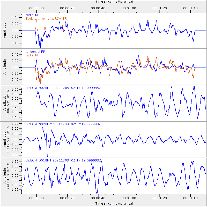
EGMT Eagleton, Montana, USA - Earthquake Result Viewer
*The percent match for this event was below the threshold and hence no stack was calculated.
| Earthquake location: |
Ryukyu Islands, Japan |
| Earthquake latitude/longitude: |
29.4/129.4 |
| Earthquake time(UTC): |
2021/12/09 (343) 02:05:07 GMT |
| Earthquake Depth: |
10 km |
| Earthquake Magnitude: |
5.9 Mww |
| Earthquake Catalog/Contributor: |
NEIC PDE/us |
|
| Network: |
US United States National Seismic Network |
| Station: |
EGMT Eagleton, Montana, USA |
| Lat/Lon: |
48.02 N/109.75 W |
| Elevation: |
1055 m |
|
| Distance: |
86.5 deg |
| Az: |
35.272 deg |
| Baz: |
311.36 deg |
| Ray Param: |
$rayparam |
*The percent match for this event was below the threshold and hence was not used in the summary stack. |
|
| Radial Match: |
65.390236 % |
| Radial Bump: |
400 |
| Transverse Match: |
67.719 % |
| Transverse Bump: |
400 |
| SOD ConfigId: |
26694651 |
| Insert Time: |
2021-12-23 02:25:30.551 +0000 |
| GWidth: |
2.5 |
| Max Bumps: |
400 |
| Tol: |
0.001 |
|
Signal To Noise
| Channel | StoN | STA | LTA |
| US:EGMT:00:BHZ:20211209T02:17:19.099999Z | 3.5448499 | 1.1709724E-6 | 3.303306E-7 |
| US:EGMT:00:BH1:20211209T02:17:19.099999Z | 1.3771765 | 6.7034233E-7 | 4.867512E-7 |
| US:EGMT:00:BH2:20211209T02:17:19.099999Z | 1.3879229 | 8.4086975E-7 | 6.058476E-7 |
| Arrivals |
| Ps | |
| PpPs | |
| PsPs/PpSs | |


