You are here: Home > Network List > UW - Pacific Northwest Regional Seismic Network Stations List
> Station UMAT Pilot Rock, OR, USA > Earthquake Result Viewer
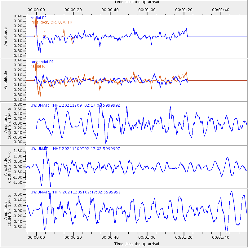
UMAT Pilot Rock, OR, USA - Earthquake Result Viewer
*The percent match for this event was below the threshold and hence no stack was calculated.
| Earthquake location: |
Ryukyu Islands, Japan |
| Earthquake latitude/longitude: |
29.4/129.4 |
| Earthquake time(UTC): |
2021/12/09 (343) 02:05:07 GMT |
| Earthquake Depth: |
10 km |
| Earthquake Magnitude: |
5.9 Mww |
| Earthquake Catalog/Contributor: |
NEIC PDE/us |
|
| Network: |
UW Pacific Northwest Regional Seismic Network |
| Station: |
UMAT Pilot Rock, OR, USA |
| Lat/Lon: |
45.29 N/118.96 W |
| Elevation: |
1318 m |
|
| Distance: |
83.2 deg |
| Az: |
41.363 deg |
| Baz: |
305.229 deg |
| Ray Param: |
$rayparam |
*The percent match for this event was below the threshold and hence was not used in the summary stack. |
|
| Radial Match: |
68.66404 % |
| Radial Bump: |
400 |
| Transverse Match: |
34.10259 % |
| Transverse Bump: |
400 |
| SOD ConfigId: |
26694651 |
| Insert Time: |
2021-12-23 02:26:59.043 +0000 |
| GWidth: |
2.5 |
| Max Bumps: |
400 |
| Tol: |
0.001 |
|
Signal To Noise
| Channel | StoN | STA | LTA |
| UW:UMAT: :HHZ:20211209T02:17:02.599999Z | 4.2386265 | 9.3771393E-7 | 2.2123061E-7 |
| UW:UMAT: :HHN:20211209T02:17:02.599999Z | 1.2927468 | 2.7457958E-7 | 2.1240011E-7 |
| UW:UMAT: :HHE:20211209T02:17:02.599999Z | 1.558853 | 4.5989492E-7 | 2.9502135E-7 |
| Arrivals |
| Ps | |
| PpPs | |
| PsPs/PpSs | |


