You are here: Home > Network List > AV - Alaska Volcano Observatory Stations List
> Station SPCR Ckakachatna River, Mount Spurr, Alaska > Earthquake Result Viewer
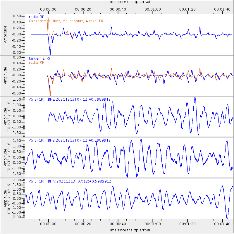
SPCR Ckakachatna River, Mount Spurr, Alaska - Earthquake Result Viewer
*The percent match for this event was below the threshold and hence no stack was calculated.
| Earthquake location: |
Mexico-Guatemala Border Region |
| Earthquake latitude/longitude: |
15.6/-92.0 |
| Earthquake time(UTC): |
2021/12/13 (347) 07:03:08 GMT |
| Earthquake Depth: |
180 km |
| Earthquake Magnitude: |
5.7 mww |
| Earthquake Catalog/Contributor: |
NEIC PDE/us |
|
| Network: |
AV Alaska Volcano Observatory |
| Station: |
SPCR Ckakachatna River, Mount Spurr, Alaska |
| Lat/Lon: |
61.20 N/152.21 W |
| Elevation: |
984 m |
|
| Distance: |
62.3 deg |
| Az: |
331.669 deg |
| Baz: |
109.161 deg |
| Ray Param: |
$rayparam |
*The percent match for this event was below the threshold and hence was not used in the summary stack. |
|
| Radial Match: |
52.945297 % |
| Radial Bump: |
385 |
| Transverse Match: |
59.047195 % |
| Transverse Bump: |
400 |
| SOD ConfigId: |
26694651 |
| Insert Time: |
2021-12-27 07:07:37.764 +0000 |
| GWidth: |
2.5 |
| Max Bumps: |
400 |
| Tol: |
0.001 |
|
Signal To Noise
| Channel | StoN | STA | LTA |
| AV:SPCR: :BHZ:20211213T07:12:40.598991Z | 0.91345346 | 3.673122E-7 | 4.0211376E-7 |
| AV:SPCR: :BHN:20211213T07:12:40.598991Z | 1.1560309 | 5.584337E-7 | 4.830613E-7 |
| AV:SPCR: :BHE:20211213T07:12:40.598991Z | 2.9527438 | 9.3739754E-7 | 3.1746663E-7 |
| Arrivals |
| Ps | |
| PpPs | |
| PsPs/PpSs | |


