You are here: Home > Network List > TX - Texas Seismological Network Stations List
> Station WTFS Witchita Falls > Earthquake Result Viewer
WTFS Witchita Falls - Earthquake Result Viewer
*The percent match for this event was below the threshold and hence no stack was calculated.
| Earthquake location: |
Hokkaido, Japan Region |
| Earthquake latitude/longitude: |
42.7/145.6 |
| Earthquake time(UTC): |
2018/05/17 (137) 18:42:10 GMT |
| Earthquake Depth: |
10 km |
| Earthquake Magnitude: |
5.8 Mww |
| Earthquake Catalog/Contributor: |
NEIC PDE/us |
|
| Network: |
TX Texas Seismological Network |
| Station: |
WTFS Witchita Falls |
| Lat/Lon: |
33.77 N/98.46 W |
| Elevation: |
277 m |
|
| Distance: |
84.0 deg |
| Az: |
48.878 deg |
| Baz: |
318.172 deg |
| Ray Param: |
$rayparam |
*The percent match for this event was below the threshold and hence was not used in the summary stack. |
|
| Radial Match: |
54.616234 % |
| Radial Bump: |
400 |
| Transverse Match: |
67.51893 % |
| Transverse Bump: |
382 |
| SOD ConfigId: |
2665671 |
| Insert Time: |
2018-05-31 18:51:59.610 +0000 |
| GWidth: |
2.5 |
| Max Bumps: |
400 |
| Tol: |
0.001 |
|
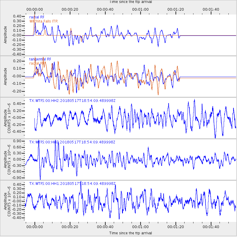
Signal To Noise
| Channel | StoN | STA | LTA |
| TX:WTFS:00:HHZ:20180517T18:54:09.489998Z | 4.227173 | 3.8182864E-7 | 9.032719E-8 |
| TX:WTFS:00:HH1:20180517T18:54:09.489998Z | 1.3613786 | 1.1665837E-7 | 8.5691354E-8 |
| TX:WTFS:00:HH2:20180517T18:54:09.489998Z | 1.3396093 | 1.8668447E-7 | 1.3935741E-7 |
| Arrivals |
| Ps | |
| PpPs | |
| PsPs/PpSs | |


