You are here: Home > Network List > AV - Alaska Volcano Observatory Stations List
> Station TAPA Point Aries, Tanaga Volcano, Alaska > Earthquake Result Viewer
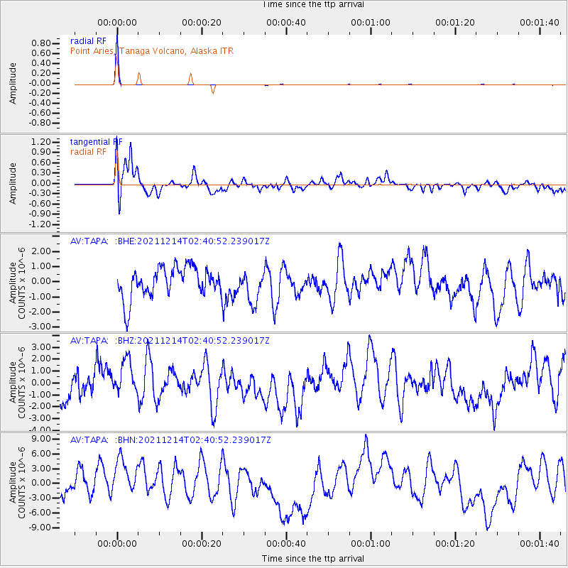
TAPA Point Aries, Tanaga Volcano, Alaska - Earthquake Result Viewer
*The percent match for this event was below the threshold and hence no stack was calculated.
| Earthquake location: |
Gulf Of California |
| Earthquake latitude/longitude: |
24.8/-109.2 |
| Earthquake time(UTC): |
2021/12/14 (348) 02:31:32 GMT |
| Earthquake Depth: |
10 km |
| Earthquake Magnitude: |
5.1 Mww |
| Earthquake Catalog/Contributor: |
NEIC PDE/us |
|
| Network: |
AV Alaska Volcano Observatory |
| Station: |
TAPA Point Aries, Tanaga Volcano, Alaska |
| Lat/Lon: |
51.81 N/177.81 W |
| Elevation: |
640 m |
|
| Distance: |
57.8 deg |
| Az: |
316.917 deg |
| Baz: |
90.081 deg |
| Ray Param: |
$rayparam |
*The percent match for this event was below the threshold and hence was not used in the summary stack. |
|
| Radial Match: |
99.5417 % |
| Radial Bump: |
42 |
| Transverse Match: |
52.41459 % |
| Transverse Bump: |
400 |
| SOD ConfigId: |
26694651 |
| Insert Time: |
2021-12-28 02:34:54.538 +0000 |
| GWidth: |
2.5 |
| Max Bumps: |
400 |
| Tol: |
0.001 |
|
Signal To Noise
| Channel | StoN | STA | LTA |
| AV:TAPA: :BHZ:20211214T02:40:52.239017Z | 1.0952169 | 1.5273475E-6 | 1.3945618E-6 |
| AV:TAPA: :BHN:20211214T02:40:52.239017Z | 1.9139528 | 4.8690845E-6 | 2.5439938E-6 |
| AV:TAPA: :BHE:20211214T02:40:52.239017Z | 1.0546981 | 1.0533095E-6 | 9.986834E-7 |
| Arrivals |
| Ps | |
| PpPs | |
| PsPs/PpSs | |


