You are here: Home > Network List > US - United States National Seismic Network Stations List
> Station AGMN Agassiz National Wildlife Refuge, Minnesota, USA > Earthquake Result Viewer
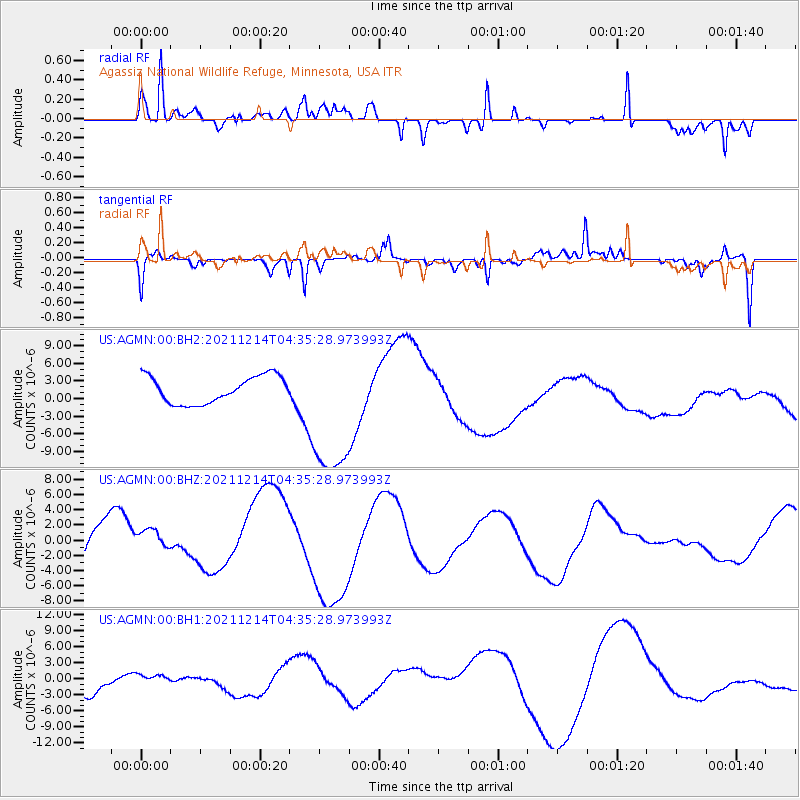
AGMN Agassiz National Wildlife Refuge, Minnesota, USA - Earthquake Result Viewer
*The percent match for this event was below the threshold and hence no stack was calculated.
| Earthquake location: |
Near Coast Of Central Chile |
| Earthquake latitude/longitude: |
-28.6/-71.7 |
| Earthquake time(UTC): |
2021/12/14 (348) 04:23:55 GMT |
| Earthquake Depth: |
22 km |
| Earthquake Magnitude: |
5.5 Mwr |
| Earthquake Catalog/Contributor: |
NEIC PDE/us |
|
| Network: |
US United States National Seismic Network |
| Station: |
AGMN Agassiz National Wildlife Refuge, Minnesota, USA |
| Lat/Lon: |
48.30 N/95.86 W |
| Elevation: |
351 m |
|
| Distance: |
79.6 deg |
| Az: |
343.849 deg |
| Baz: |
158.517 deg |
| Ray Param: |
$rayparam |
*The percent match for this event was below the threshold and hence was not used in the summary stack. |
|
| Radial Match: |
86.65304 % |
| Radial Bump: |
400 |
| Transverse Match: |
51.578514 % |
| Transverse Bump: |
280 |
| SOD ConfigId: |
26694651 |
| Insert Time: |
2021-12-28 04:40:15.658 +0000 |
| GWidth: |
2.5 |
| Max Bumps: |
400 |
| Tol: |
0.001 |
|
Signal To Noise
| Channel | StoN | STA | LTA |
| US:AGMN:00:BHZ:20211214T04:35:28.973993Z | 0.30329052 | 1.512073E-6 | 4.98556E-6 |
| US:AGMN:00:BH1:20211214T04:35:28.973993Z | 0.30908054 | 1.0907916E-6 | 3.52915E-6 |
| US:AGMN:00:BH2:20211214T04:35:28.973993Z | 5.3952236 | 1.2308196E-5 | 2.2813135E-6 |
| Arrivals |
| Ps | |
| PpPs | |
| PsPs/PpSs | |


