You are here: Home > Network List > C8 - Canadian Seismic Research Network () Stations List
> Station GRIB Gribbell Island, BC, CA > Earthquake Result Viewer
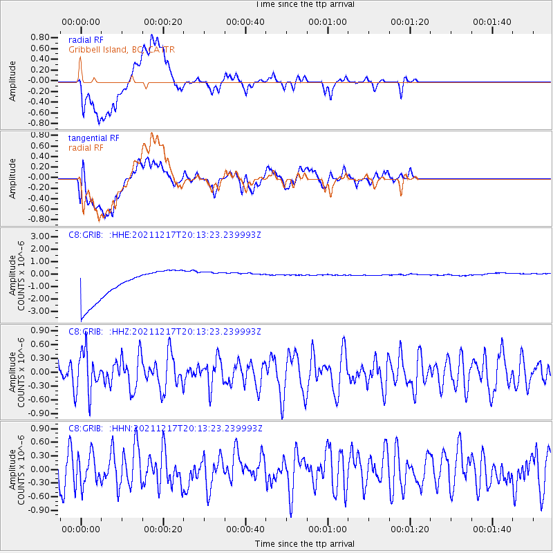
GRIB Gribbell Island, BC, CA - Earthquake Result Viewer
*The percent match for this event was below the threshold and hence no stack was calculated.
| Earthquake location: |
Fiji Islands Region |
| Earthquake latitude/longitude: |
-17.9/-178.5 |
| Earthquake time(UTC): |
2021/12/17 (351) 20:02:28 GMT |
| Earthquake Depth: |
558 km |
| Earthquake Magnitude: |
5.7 Mww |
| Earthquake Catalog/Contributor: |
NEIC PDE/us |
|
| Network: |
C8 Canadian Seismic Research Network () |
| Station: |
GRIB Gribbell Island, BC, CA |
| Lat/Lon: |
53.34 N/129.14 W |
| Elevation: |
418 m |
|
| Distance: |
82.7 deg |
| Az: |
27.307 deg |
| Baz: |
226.741 deg |
| Ray Param: |
$rayparam |
*The percent match for this event was below the threshold and hence was not used in the summary stack. |
|
| Radial Match: |
20.06931 % |
| Radial Bump: |
400 |
| Transverse Match: |
21.528807 % |
| Transverse Bump: |
400 |
| SOD ConfigId: |
26694651 |
| Insert Time: |
2021-12-31 20:08:53.964 +0000 |
| GWidth: |
2.5 |
| Max Bumps: |
400 |
| Tol: |
0.001 |
|
Signal To Noise
| Channel | StoN | STA | LTA |
| C8:GRIB: :HHZ:20211217T20:13:23.239993Z | 1.2105825 | 4.378336E-7 | 3.6167185E-7 |
| C8:GRIB: :HHN:20211217T20:13:23.239993Z | 0.96204287 | 3.2826836E-7 | 3.4122007E-7 |
| C8:GRIB: :HHE:20211217T20:13:23.239993Z | 0.8228959 | 9.762605E-7 | 1.1863718E-6 |
| Arrivals |
| Ps | |
| PpPs | |
| PsPs/PpSs | |


