You are here: Home > Network List > CI - Caltech Regional Seismic Network Stations List
> Station SMM Simmler, CA, USA > Earthquake Result Viewer
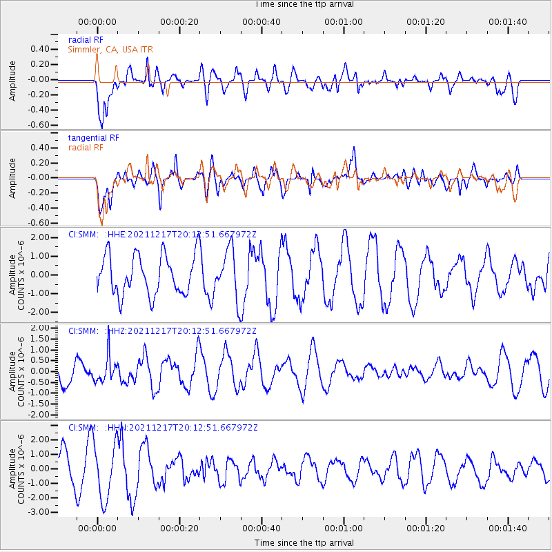
SMM Simmler, CA, USA - Earthquake Result Viewer
*The percent match for this event was below the threshold and hence no stack was calculated.
| Earthquake location: |
Fiji Islands Region |
| Earthquake latitude/longitude: |
-17.9/-178.5 |
| Earthquake time(UTC): |
2021/12/17 (351) 20:02:28 GMT |
| Earthquake Depth: |
558 km |
| Earthquake Magnitude: |
5.7 Mww |
| Earthquake Catalog/Contributor: |
NEIC PDE/us |
|
| Network: |
CI Caltech Regional Seismic Network |
| Station: |
SMM Simmler, CA, USA |
| Lat/Lon: |
35.31 N/120.00 W |
| Elevation: |
599 m |
|
| Distance: |
76.7 deg |
| Az: |
45.778 deg |
| Baz: |
236.532 deg |
| Ray Param: |
$rayparam |
*The percent match for this event was below the threshold and hence was not used in the summary stack. |
|
| Radial Match: |
65.0775 % |
| Radial Bump: |
400 |
| Transverse Match: |
40.43725 % |
| Transverse Bump: |
372 |
| SOD ConfigId: |
26694651 |
| Insert Time: |
2021-12-31 20:11:06.805 +0000 |
| GWidth: |
2.5 |
| Max Bumps: |
400 |
| Tol: |
0.001 |
|
Signal To Noise
| Channel | StoN | STA | LTA |
| CI:SMM: :HHZ:20211217T20:12:51.667972Z | 1.0534134 | 6.341431E-7 | 6.0198875E-7 |
| CI:SMM: :HHN:20211217T20:12:51.667972Z | 2.070903 | 1.9226288E-6 | 9.2840116E-7 |
| CI:SMM: :HHE:20211217T20:12:51.667972Z | 1.2849851 | 1.3613278E-6 | 1.0594114E-6 |
| Arrivals |
| Ps | |
| PpPs | |
| PsPs/PpSs | |


