You are here: Home > Network List > US - United States National Seismic Network Stations List
> Station EGMT Eagleton, Montana, USA > Earthquake Result Viewer
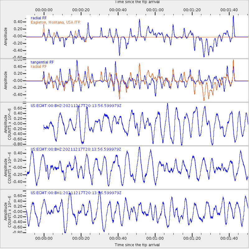
EGMT Eagleton, Montana, USA - Earthquake Result Viewer
*The percent match for this event was below the threshold and hence no stack was calculated.
| Earthquake location: |
Fiji Islands Region |
| Earthquake latitude/longitude: |
-17.9/-178.5 |
| Earthquake time(UTC): |
2021/12/17 (351) 20:02:28 GMT |
| Earthquake Depth: |
558 km |
| Earthquake Magnitude: |
5.7 Mww |
| Earthquake Catalog/Contributor: |
NEIC PDE/us |
|
| Network: |
US United States National Seismic Network |
| Station: |
EGMT Eagleton, Montana, USA |
| Lat/Lon: |
48.02 N/109.75 W |
| Elevation: |
1055 m |
|
| Distance: |
89.7 deg |
| Az: |
38.73 deg |
| Baz: |
242.527 deg |
| Ray Param: |
$rayparam |
*The percent match for this event was below the threshold and hence was not used in the summary stack. |
|
| Radial Match: |
53.930603 % |
| Radial Bump: |
400 |
| Transverse Match: |
55.152164 % |
| Transverse Bump: |
400 |
| SOD ConfigId: |
26694651 |
| Insert Time: |
2021-12-31 20:20:24.329 +0000 |
| GWidth: |
2.5 |
| Max Bumps: |
400 |
| Tol: |
0.001 |
|
Signal To Noise
| Channel | StoN | STA | LTA |
| US:EGMT:00:BHZ:20211217T20:13:56.599979Z | 0.76230377 | 1.9401243E-7 | 2.5450802E-7 |
| US:EGMT:00:BH1:20211217T20:13:56.599979Z | 1.2283397 | 2.6682235E-7 | 2.1722197E-7 |
| US:EGMT:00:BH2:20211217T20:13:56.599979Z | 0.8642155 | 2.9243083E-7 | 3.3837722E-7 |
| Arrivals |
| Ps | |
| PpPs | |
| PsPs/PpSs | |


