You are here: Home > Network List > US - United States National Seismic Network Stations List
> Station WMOK Wichita Mountains, Oklahoma, USA > Earthquake Result Viewer
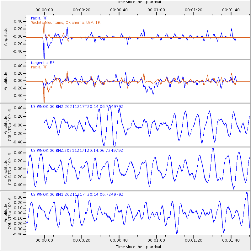
WMOK Wichita Mountains, Oklahoma, USA - Earthquake Result Viewer
*The percent match for this event was below the threshold and hence no stack was calculated.
| Earthquake location: |
Fiji Islands Region |
| Earthquake latitude/longitude: |
-17.9/-178.5 |
| Earthquake time(UTC): |
2021/12/17 (351) 20:02:28 GMT |
| Earthquake Depth: |
558 km |
| Earthquake Magnitude: |
5.7 Mww |
| Earthquake Catalog/Contributor: |
NEIC PDE/us |
|
| Network: |
US United States National Seismic Network |
| Station: |
WMOK Wichita Mountains, Oklahoma, USA |
| Lat/Lon: |
34.74 N/98.78 W |
| Elevation: |
486 m |
|
| Distance: |
91.9 deg |
| Az: |
54.174 deg |
| Baz: |
249.589 deg |
| Ray Param: |
$rayparam |
*The percent match for this event was below the threshold and hence was not used in the summary stack. |
|
| Radial Match: |
59.946083 % |
| Radial Bump: |
381 |
| Transverse Match: |
50.03039 % |
| Transverse Bump: |
400 |
| SOD ConfigId: |
26694651 |
| Insert Time: |
2021-12-31 20:20:35.736 +0000 |
| GWidth: |
2.5 |
| Max Bumps: |
400 |
| Tol: |
0.001 |
|
Signal To Noise
| Channel | StoN | STA | LTA |
| US:WMOK:00:BHZ:20211217T20:14:06.724979Z | 0.79594535 | 1.6529756E-7 | 2.0767452E-7 |
| US:WMOK:00:BH1:20211217T20:14:06.724979Z | 0.82311976 | 1.1331141E-7 | 1.376609E-7 |
| US:WMOK:00:BH2:20211217T20:14:06.724979Z | 3.4067307 | 3.2861286E-7 | 9.645989E-8 |
| Arrivals |
| Ps | |
| PpPs | |
| PsPs/PpSs | |


