You are here: Home > Network List > UW - Pacific Northwest Regional Seismic Network Stations List
> Station IRON Crane, OR, USA > Earthquake Result Viewer
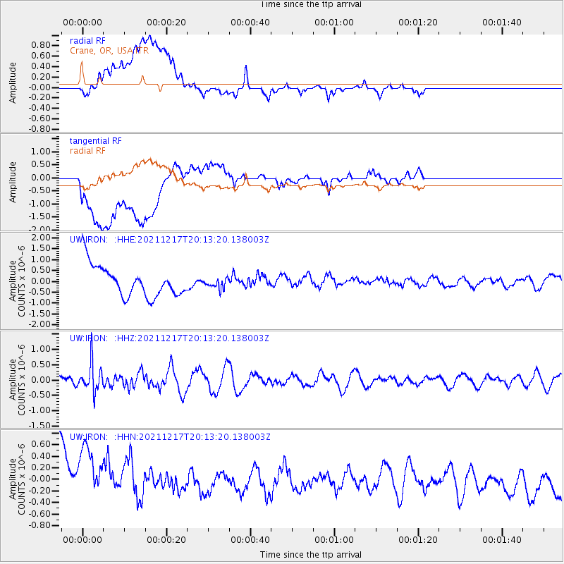
IRON Crane, OR, USA - Earthquake Result Viewer
*The percent match for this event was below the threshold and hence no stack was calculated.
| Earthquake location: |
Fiji Islands Region |
| Earthquake latitude/longitude: |
-17.9/-178.5 |
| Earthquake time(UTC): |
2021/12/17 (351) 20:02:28 GMT |
| Earthquake Depth: |
558 km |
| Earthquake Magnitude: |
5.7 Mww |
| Earthquake Catalog/Contributor: |
NEIC PDE/us |
|
| Network: |
UW Pacific Northwest Regional Seismic Network |
| Station: |
IRON Crane, OR, USA |
| Lat/Lon: |
43.36 N/118.47 W |
| Elevation: |
1226 m |
|
| Distance: |
82.1 deg |
| Az: |
39.634 deg |
| Baz: |
236.361 deg |
| Ray Param: |
$rayparam |
*The percent match for this event was below the threshold and hence was not used in the summary stack. |
|
| Radial Match: |
37.986206 % |
| Radial Bump: |
400 |
| Transverse Match: |
41.095524 % |
| Transverse Bump: |
400 |
| SOD ConfigId: |
26694651 |
| Insert Time: |
2021-12-31 20:21:09.421 +0000 |
| GWidth: |
2.5 |
| Max Bumps: |
400 |
| Tol: |
0.001 |
|
Signal To Noise
| Channel | StoN | STA | LTA |
| UW:IRON: :HHZ:20211217T20:13:20.138003Z | 1.792604 | 4.6462793E-7 | 2.5919164E-7 |
| UW:IRON: :HHN:20211217T20:13:20.138003Z | 0.7729041 | 1.0835469E-6 | 1.4019163E-6 |
| UW:IRON: :HHE:20211217T20:13:20.138003Z | 0.3036449 | 2.1495893E-7 | 7.079287E-7 |
| Arrivals |
| Ps | |
| PpPs | |
| PsPs/PpSs | |


