You are here: Home > Network List > UW - Pacific Northwest Regional Seismic Network Stations List
> Station UMAT Pilot Rock, OR, USA > Earthquake Result Viewer
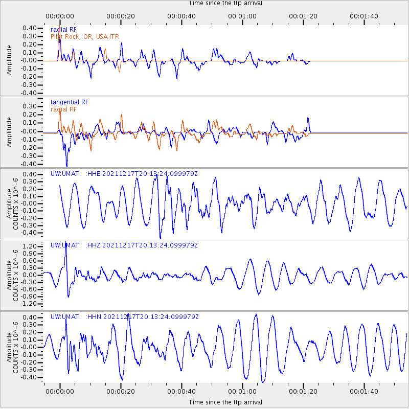
UMAT Pilot Rock, OR, USA - Earthquake Result Viewer
*The percent match for this event was below the threshold and hence no stack was calculated.
| Earthquake location: |
Fiji Islands Region |
| Earthquake latitude/longitude: |
-17.9/-178.5 |
| Earthquake time(UTC): |
2021/12/17 (351) 20:02:28 GMT |
| Earthquake Depth: |
558 km |
| Earthquake Magnitude: |
5.7 Mww |
| Earthquake Catalog/Contributor: |
NEIC PDE/us |
|
| Network: |
UW Pacific Northwest Regional Seismic Network |
| Station: |
UMAT Pilot Rock, OR, USA |
| Lat/Lon: |
45.29 N/118.96 W |
| Elevation: |
1318 m |
|
| Distance: |
82.9 deg |
| Az: |
37.821 deg |
| Baz: |
235.786 deg |
| Ray Param: |
$rayparam |
*The percent match for this event was below the threshold and hence was not used in the summary stack. |
|
| Radial Match: |
71.23802 % |
| Radial Bump: |
400 |
| Transverse Match: |
59.32242 % |
| Transverse Bump: |
400 |
| SOD ConfigId: |
26694651 |
| Insert Time: |
2021-12-31 20:21:47.630 +0000 |
| GWidth: |
2.5 |
| Max Bumps: |
400 |
| Tol: |
0.001 |
|
Signal To Noise
| Channel | StoN | STA | LTA |
| UW:UMAT: :HHZ:20211217T20:13:24.099979Z | 2.954114 | 5.446052E-7 | 1.8435485E-7 |
| UW:UMAT: :HHN:20211217T20:13:24.099979Z | 0.92541337 | 1.6644421E-7 | 1.798593E-7 |
| UW:UMAT: :HHE:20211217T20:13:24.099979Z | 1.5131458 | 2.7039462E-7 | 1.7869701E-7 |
| Arrivals |
| Ps | |
| PpPs | |
| PsPs/PpSs | |


