You are here: Home > Network List > IW - Intermountain West Stations List
> Station PLID Pearl Lake, Idaho, USA > Earthquake Result Viewer
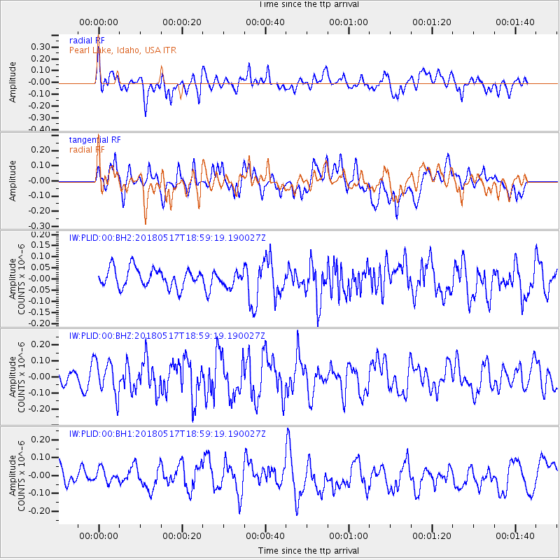
PLID Pearl Lake, Idaho, USA - Earthquake Result Viewer
*The percent match for this event was below the threshold and hence no stack was calculated.
| Earthquake location: |
South Of Mariana Islands |
| Earthquake latitude/longitude: |
13.0/145.3 |
| Earthquake time(UTC): |
2018/05/17 (137) 18:47:09 GMT |
| Earthquake Depth: |
37 km |
| Earthquake Magnitude: |
5.5 mb |
| Earthquake Catalog/Contributor: |
NEIC PDE/us |
|
| Network: |
IW Intermountain West |
| Station: |
PLID Pearl Lake, Idaho, USA |
| Lat/Lon: |
45.09 N/116.00 W |
| Elevation: |
2164 m |
|
| Distance: |
86.9 deg |
| Az: |
44.534 deg |
| Baz: |
285.202 deg |
| Ray Param: |
$rayparam |
*The percent match for this event was below the threshold and hence was not used in the summary stack. |
|
| Radial Match: |
48.693497 % |
| Radial Bump: |
400 |
| Transverse Match: |
40.554935 % |
| Transverse Bump: |
400 |
| SOD ConfigId: |
2665671 |
| Insert Time: |
2018-05-31 18:57:08.070 +0000 |
| GWidth: |
2.5 |
| Max Bumps: |
400 |
| Tol: |
0.001 |
|
Signal To Noise
| Channel | StoN | STA | LTA |
| IW:PLID:00:BHZ:20180517T18:59:19.190027Z | 2.1168354 | 1.05762936E-7 | 4.9962765E-8 |
| IW:PLID:00:BH1:20180517T18:59:19.190027Z | 0.70751625 | 4.0813834E-8 | 5.7686073E-8 |
| IW:PLID:00:BH2:20180517T18:59:19.190027Z | 0.7824295 | 3.3072183E-8 | 4.226858E-8 |
| Arrivals |
| Ps | |
| PpPs | |
| PsPs/PpSs | |


