You are here: Home > Network List > US - United States National Seismic Network Stations List
> Station LONY Lake Ozonia, New York, USA > Earthquake Result Viewer
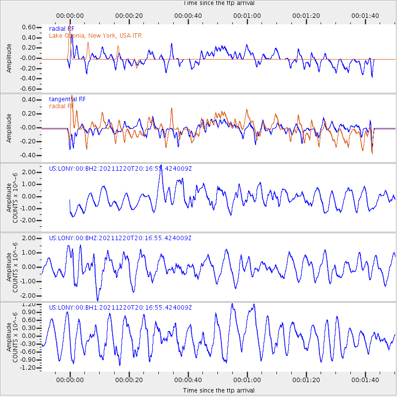
LONY Lake Ozonia, New York, USA - Earthquake Result Viewer
*The percent match for this event was below the threshold and hence no stack was calculated.
| Earthquake location: |
Near Coast Of Northern Calif. |
| Earthquake latitude/longitude: |
40.3/-124.7 |
| Earthquake time(UTC): |
2021/12/20 (354) 20:10:18 GMT |
| Earthquake Depth: |
9.3 km |
| Earthquake Magnitude: |
6.2 Mw |
| Earthquake Catalog/Contributor: |
NEIC PDE/nc |
|
| Network: |
US United States National Seismic Network |
| Station: |
LONY Lake Ozonia, New York, USA |
| Lat/Lon: |
44.62 N/74.58 W |
| Elevation: |
440 m |
|
| Distance: |
36.8 deg |
| Az: |
66.327 deg |
| Baz: |
281.299 deg |
| Ray Param: |
$rayparam |
*The percent match for this event was below the threshold and hence was not used in the summary stack. |
|
| Radial Match: |
39.43937 % |
| Radial Bump: |
400 |
| Transverse Match: |
68.519966 % |
| Transverse Bump: |
400 |
| SOD ConfigId: |
26694651 |
| Insert Time: |
2022-01-03 20:20:26.314 +0000 |
| GWidth: |
2.5 |
| Max Bumps: |
400 |
| Tol: |
0.001 |
|
Signal To Noise
| Channel | StoN | STA | LTA |
| US:LONY:00:BHZ:20211220T20:16:55.424009Z | 3.140726 | 1.0648486E-6 | 3.3904533E-7 |
| US:LONY:00:BH1:20211220T20:16:55.424009Z | 1.3629674 | 6.790216E-7 | 4.9819363E-7 |
| US:LONY:00:BH2:20211220T20:16:55.424009Z | 2.2765522 | 1.3894609E-6 | 6.103356E-7 |
| Arrivals |
| Ps | |
| PpPs | |
| PsPs/PpSs | |


