You are here: Home > Network List > IW - Intermountain West Stations List
> Station DLMT Dillon, Montana, USA > Earthquake Result Viewer
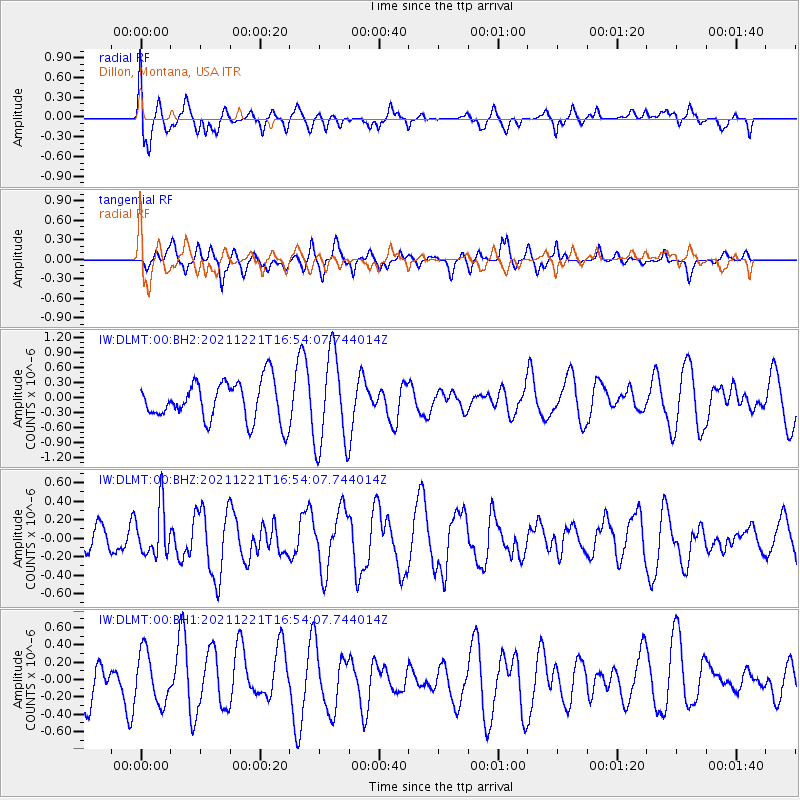
DLMT Dillon, Montana, USA - Earthquake Result Viewer
*The percent match for this event was below the threshold and hence no stack was calculated.
| Earthquake location: |
Southeast Of Honshu, Japan |
| Earthquake latitude/longitude: |
31.2/142.3 |
| Earthquake time(UTC): |
2021/12/21 (355) 16:42:40 GMT |
| Earthquake Depth: |
10 km |
| Earthquake Magnitude: |
4.9 Mww |
| Earthquake Catalog/Contributor: |
NEIC PDE/us |
|
| Network: |
IW Intermountain West |
| Station: |
DLMT Dillon, Montana, USA |
| Lat/Lon: |
45.36 N/112.60 W |
| Elevation: |
1569 m |
|
| Distance: |
78.0 deg |
| Az: |
44.096 deg |
| Baz: |
302.261 deg |
| Ray Param: |
$rayparam |
*The percent match for this event was below the threshold and hence was not used in the summary stack. |
|
| Radial Match: |
44.505196 % |
| Radial Bump: |
400 |
| Transverse Match: |
65.479256 % |
| Transverse Bump: |
400 |
| SOD ConfigId: |
26694651 |
| Insert Time: |
2022-01-04 16:55:17.682 +0000 |
| GWidth: |
2.5 |
| Max Bumps: |
400 |
| Tol: |
0.001 |
|
Signal To Noise
| Channel | StoN | STA | LTA |
| IW:DLMT:00:BHZ:20211221T16:54:07.744014Z | 1.3084201 | 2.6061787E-7 | 1.9918518E-7 |
| IW:DLMT:00:BH1:20211221T16:54:07.744014Z | 1.1080797 | 2.9319443E-7 | 2.645969E-7 |
| IW:DLMT:00:BH2:20211221T16:54:07.744014Z | 2.3716686 | 9.297627E-7 | 3.920289E-7 |
| Arrivals |
| Ps | |
| PpPs | |
| PsPs/PpSs | |


