You are here: Home > Network List > UW - Pacific Northwest Regional Seismic Network Stations List
> Station IRON Crane, OR, USA > Earthquake Result Viewer
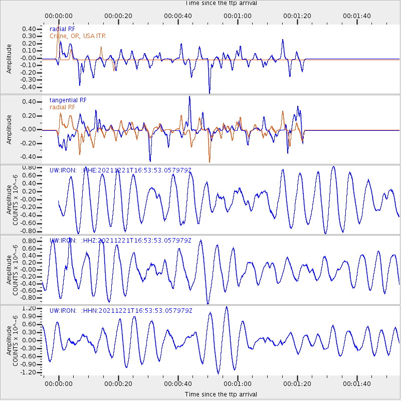
IRON Crane, OR, USA - Earthquake Result Viewer
*The percent match for this event was below the threshold and hence no stack was calculated.
| Earthquake location: |
Southeast Of Honshu, Japan |
| Earthquake latitude/longitude: |
31.2/142.3 |
| Earthquake time(UTC): |
2021/12/21 (355) 16:42:40 GMT |
| Earthquake Depth: |
10 km |
| Earthquake Magnitude: |
4.9 Mww |
| Earthquake Catalog/Contributor: |
NEIC PDE/us |
|
| Network: |
UW Pacific Northwest Regional Seismic Network |
| Station: |
IRON Crane, OR, USA |
| Lat/Lon: |
43.36 N/118.47 W |
| Elevation: |
1226 m |
|
| Distance: |
75.4 deg |
| Az: |
48.075 deg |
| Baz: |
299.081 deg |
| Ray Param: |
$rayparam |
*The percent match for this event was below the threshold and hence was not used in the summary stack. |
|
| Radial Match: |
77.657036 % |
| Radial Bump: |
400 |
| Transverse Match: |
61.809086 % |
| Transverse Bump: |
391 |
| SOD ConfigId: |
26694651 |
| Insert Time: |
2022-01-04 17:03:39.473 +0000 |
| GWidth: |
2.5 |
| Max Bumps: |
400 |
| Tol: |
0.001 |
|
Signal To Noise
| Channel | StoN | STA | LTA |
| UW:IRON: :HHZ:20211221T16:53:53.057979Z | 2.3249326 | 5.0404486E-7 | 2.1679978E-7 |
| UW:IRON: :HHN:20211221T16:53:53.057979Z | 0.9178198 | 3.4868603E-7 | 3.7990685E-7 |
| UW:IRON: :HHE:20211221T16:53:53.057979Z | 0.4173781 | 2.070808E-7 | 4.961468E-7 |
| Arrivals |
| Ps | |
| PpPs | |
| PsPs/PpSs | |


