You are here: Home > Network List > US - United States National Seismic Network Stations List
> Station HAWA Hanford, Washington, USA > Earthquake Result Viewer
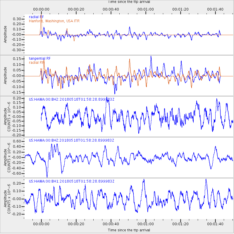
HAWA Hanford, Washington, USA - Earthquake Result Viewer
*The percent match for this event was below the threshold and hence no stack was calculated.
| Earthquake location: |
South Of Kermadec Islands |
| Earthquake latitude/longitude: |
-34.6/-178.4 |
| Earthquake time(UTC): |
2018/05/18 (138) 01:45:31 GMT |
| Earthquake Depth: |
11 km |
| Earthquake Magnitude: |
6.2 Mww |
| Earthquake Catalog/Contributor: |
NEIC PDE/us |
|
| Network: |
US United States National Seismic Network |
| Station: |
HAWA Hanford, Washington, USA |
| Lat/Lon: |
46.39 N/119.53 W |
| Elevation: |
364 m |
|
| Distance: |
96.4 deg |
| Az: |
36.607 deg |
| Baz: |
225.327 deg |
| Ray Param: |
$rayparam |
*The percent match for this event was below the threshold and hence was not used in the summary stack. |
|
| Radial Match: |
51.763535 % |
| Radial Bump: |
400 |
| Transverse Match: |
48.530674 % |
| Transverse Bump: |
400 |
| SOD ConfigId: |
2665671 |
| Insert Time: |
2018-06-01 01:48:43.926 +0000 |
| GWidth: |
2.5 |
| Max Bumps: |
400 |
| Tol: |
0.001 |
|
Signal To Noise
| Channel | StoN | STA | LTA |
| US:HAWA:00:BHZ:20180518T01:58:28.899983Z | 2.9751763 | 2.7385477E-7 | 9.204657E-8 |
| US:HAWA:00:BH1:20180518T01:58:28.899983Z | 1.4275675 | 9.073475E-8 | 6.355899E-8 |
| US:HAWA:00:BH2:20180518T01:58:28.899983Z | 0.8546131 | 5.441542E-8 | 6.367257E-8 |
| Arrivals |
| Ps | |
| PpPs | |
| PsPs/PpSs | |


