You are here: Home > Network List > GS - US Geological Survey Networks Stations List
> Station KAN13 Rinehart Farm > Earthquake Result Viewer
KAN13 Rinehart Farm - Earthquake Result Viewer
*The percent match for this event was below the threshold and hence no stack was calculated.
| Earthquake location: |
Tonga Islands |
| Earthquake latitude/longitude: |
-21.0/-174.0 |
| Earthquake time(UTC): |
2018/05/20 (140) 00:42:14 GMT |
| Earthquake Depth: |
10 km |
| Earthquake Magnitude: |
5.5 Mww |
| Earthquake Catalog/Contributor: |
NEIC PDE/us |
|
| Network: |
GS US Geological Survey Networks |
| Station: |
KAN13 Rinehart Farm |
| Lat/Lon: |
37.01 N/97.48 W |
| Elevation: |
340 m |
|
| Distance: |
92.2 deg |
| Az: |
51.168 deg |
| Baz: |
245.436 deg |
| Ray Param: |
$rayparam |
*The percent match for this event was below the threshold and hence was not used in the summary stack. |
|
| Radial Match: |
45.70945 % |
| Radial Bump: |
400 |
| Transverse Match: |
52.45988 % |
| Transverse Bump: |
400 |
| SOD ConfigId: |
2665671 |
| Insert Time: |
2018-06-03 00:51:46.339 +0000 |
| GWidth: |
2.5 |
| Max Bumps: |
400 |
| Tol: |
0.001 |
|
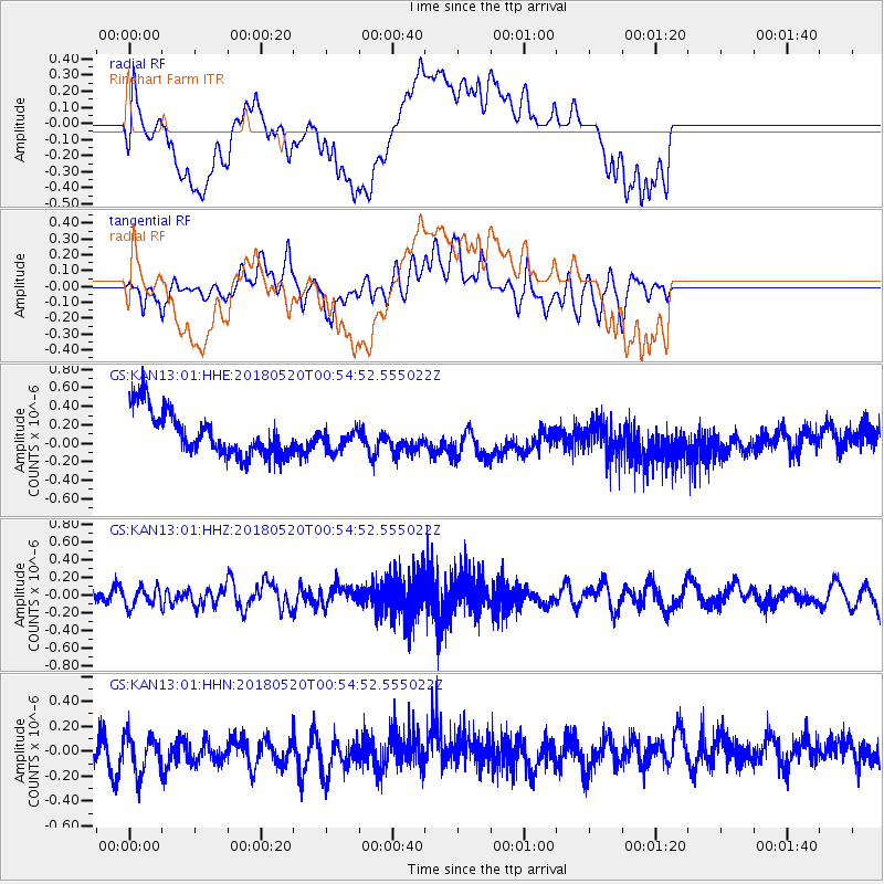
Signal To Noise
| Channel | StoN | STA | LTA |
| GS:KAN13:01:HHZ:20180520T00:54:52.555022Z | 0.9810499 | 1.0885626E-7 | 1.1095894E-7 |
| GS:KAN13:01:HHN:20180520T00:54:52.555022Z | 1.0505441 | 1.7764985E-7 | 1.6910269E-7 |
| GS:KAN13:01:HHE:20180520T00:54:52.555022Z | 0.52064806 | 1.2525237E-7 | 2.405701E-7 |
| Arrivals |
| Ps | |
| PpPs | |
| PsPs/PpSs | |


