You are here: Home > Network List > US - United States National Seismic Network Stations List
> Station EGMT Eagleton, Montana, USA > Earthquake Result Viewer
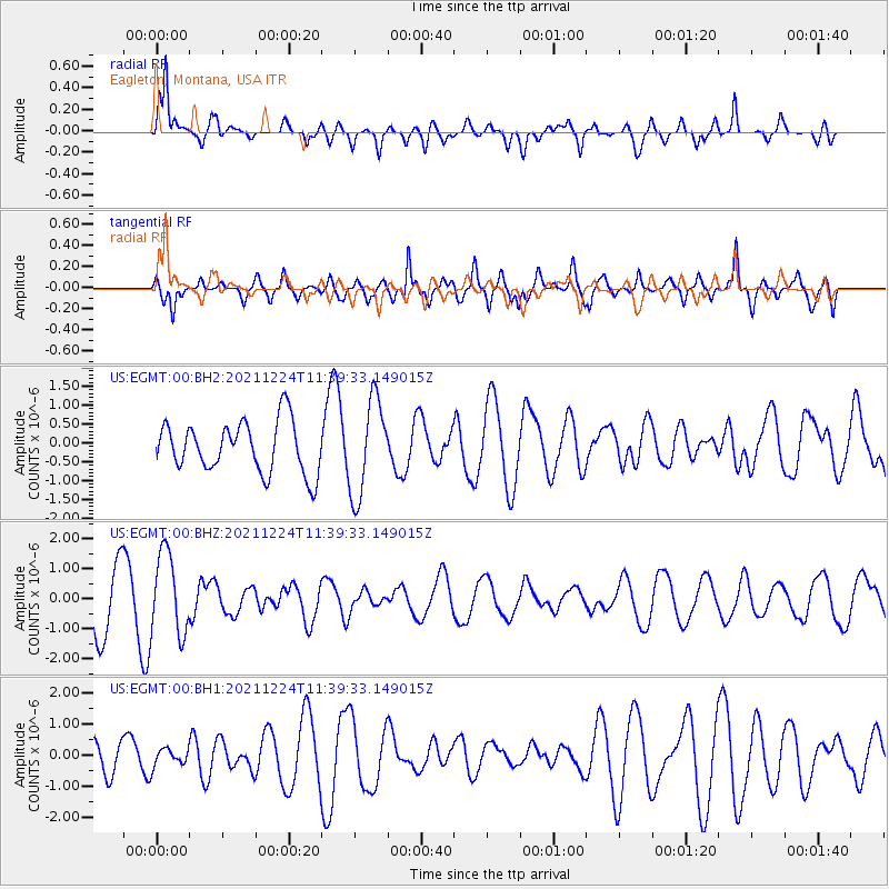
EGMT Eagleton, Montana, USA - Earthquake Result Viewer
*The percent match for this event was below the threshold and hence no stack was calculated.
| Earthquake location: |
Hawaii |
| Earthquake latitude/longitude: |
18.9/-155.2 |
| Earthquake time(UTC): |
2021/12/24 (358) 11:31:34 GMT |
| Earthquake Depth: |
11 km |
| Earthquake Magnitude: |
4.9 Ml |
| Earthquake Catalog/Contributor: |
NEIC PDE/hv |
|
| Network: |
US United States National Seismic Network |
| Station: |
EGMT Eagleton, Montana, USA |
| Lat/Lon: |
48.02 N/109.75 W |
| Elevation: |
1055 m |
|
| Distance: |
46.8 deg |
| Az: |
40.996 deg |
| Baz: |
247.725 deg |
| Ray Param: |
$rayparam |
*The percent match for this event was below the threshold and hence was not used in the summary stack. |
|
| Radial Match: |
82.426895 % |
| Radial Bump: |
400 |
| Transverse Match: |
48.42574 % |
| Transverse Bump: |
400 |
| SOD ConfigId: |
26694651 |
| Insert Time: |
2022-01-07 11:51:37.019 +0000 |
| GWidth: |
2.5 |
| Max Bumps: |
400 |
| Tol: |
0.001 |
|
Signal To Noise
| Channel | StoN | STA | LTA |
| US:EGMT:00:BHZ:20211224T11:39:33.149015Z | 1.4406887 | 1.3484157E-6 | 9.3595213E-7 |
| US:EGMT:00:BH1:20211224T11:39:33.149015Z | 0.54458076 | 2.9092016E-7 | 5.342094E-7 |
| US:EGMT:00:BH2:20211224T11:39:33.149015Z | 1.9037551 | 1.2832452E-6 | 6.7406E-7 |
| Arrivals |
| Ps | |
| PpPs | |
| PsPs/PpSs | |


