You are here: Home > Network List > AK - Alaska Regional Network Stations List
> Station MDM Murphy Dome > Earthquake Result Viewer
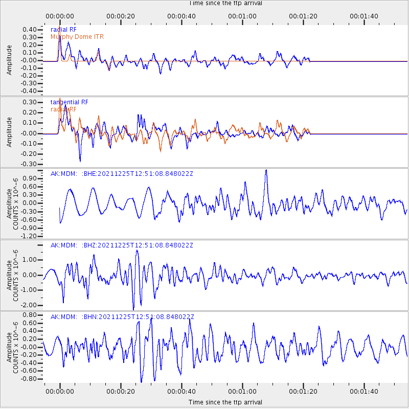
MDM Murphy Dome - Earthquake Result Viewer
*The percent match for this event was below the threshold and hence no stack was calculated.
| Earthquake location: |
Tonga Islands |
| Earthquake latitude/longitude: |
-17.1/-173.6 |
| Earthquake time(UTC): |
2021/12/25 (359) 12:39:21 GMT |
| Earthquake Depth: |
105 km |
| Earthquake Magnitude: |
6.0 Mi |
| Earthquake Catalog/Contributor: |
NEIC PDE/pt |
|
| Network: |
AK Alaska Regional Network |
| Station: |
MDM Murphy Dome |
| Lat/Lon: |
64.96 N/148.23 W |
| Elevation: |
634 m |
|
| Distance: |
84.1 deg |
| Az: |
10.572 deg |
| Baz: |
204.349 deg |
| Ray Param: |
$rayparam |
*The percent match for this event was below the threshold and hence was not used in the summary stack. |
|
| Radial Match: |
76.75022 % |
| Radial Bump: |
400 |
| Transverse Match: |
79.977554 % |
| Transverse Bump: |
400 |
| SOD ConfigId: |
26694651 |
| Insert Time: |
2022-01-08 12:41:41.193 +0000 |
| GWidth: |
2.5 |
| Max Bumps: |
400 |
| Tol: |
0.001 |
|
Signal To Noise
| Channel | StoN | STA | LTA |
| AK:MDM: :BHZ:20211225T12:51:08.848022Z | 2.5422492 | 6.5594867E-7 | 2.5801904E-7 |
| AK:MDM: :BHN:20211225T12:51:08.848022Z | 1.5784109 | 2.142241E-7 | 1.3572138E-7 |
| AK:MDM: :BHE:20211225T12:51:08.848022Z | 1.2136729 | 3.7310906E-7 | 3.0742143E-7 |
| Arrivals |
| Ps | |
| PpPs | |
| PsPs/PpSs | |


