You are here: Home > Network List > US - United States National Seismic Network Stations List
> Station MIAR Mount Ida, Arkansas, USA > Earthquake Result Viewer
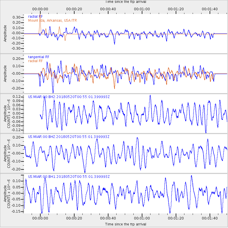
MIAR Mount Ida, Arkansas, USA - Earthquake Result Viewer
*The percent match for this event was below the threshold and hence no stack was calculated.
| Earthquake location: |
Tonga Islands |
| Earthquake latitude/longitude: |
-21.0/-174.0 |
| Earthquake time(UTC): |
2018/05/20 (140) 00:42:14 GMT |
| Earthquake Depth: |
10 km |
| Earthquake Magnitude: |
5.5 Mww |
| Earthquake Catalog/Contributor: |
NEIC PDE/us |
|
| Network: |
US United States National Seismic Network |
| Station: |
MIAR Mount Ida, Arkansas, USA |
| Lat/Lon: |
34.55 N/93.58 W |
| Elevation: |
207 m |
|
| Distance: |
94.2 deg |
| Az: |
54.696 deg |
| Baz: |
247.511 deg |
| Ray Param: |
$rayparam |
*The percent match for this event was below the threshold and hence was not used in the summary stack. |
|
| Radial Match: |
52.210907 % |
| Radial Bump: |
400 |
| Transverse Match: |
46.883957 % |
| Transverse Bump: |
400 |
| SOD ConfigId: |
2665671 |
| Insert Time: |
2018-06-03 00:54:07.120 +0000 |
| GWidth: |
2.5 |
| Max Bumps: |
400 |
| Tol: |
0.001 |
|
Signal To Noise
| Channel | StoN | STA | LTA |
| US:MIAR:00:BHZ:20180520T00:55:01.399993Z | 0.6550947 | 5.374715E-8 | 8.204486E-8 |
| US:MIAR:00:BH1:20180520T00:55:01.399993Z | 1.4916565 | 9.419473E-8 | 6.314773E-8 |
| US:MIAR:00:BH2:20180520T00:55:01.399993Z | 1.0025318 | 5.7272313E-8 | 5.7127675E-8 |
| Arrivals |
| Ps | |
| PpPs | |
| PsPs/PpSs | |


