You are here: Home > Network List > US - United States National Seismic Network Stations List
> Station MSO Missoula, Montana, USA > Earthquake Result Viewer
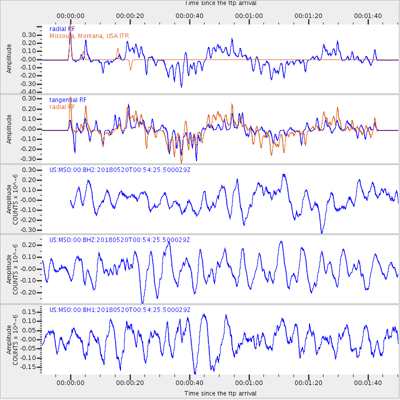
MSO Missoula, Montana, USA - Earthquake Result Viewer
*The percent match for this event was below the threshold and hence no stack was calculated.
| Earthquake location: |
Tonga Islands |
| Earthquake latitude/longitude: |
-21.0/-174.0 |
| Earthquake time(UTC): |
2018/05/20 (140) 00:42:14 GMT |
| Earthquake Depth: |
10 km |
| Earthquake Magnitude: |
5.5 Mww |
| Earthquake Catalog/Contributor: |
NEIC PDE/us |
|
| Network: |
US United States National Seismic Network |
| Station: |
MSO Missoula, Montana, USA |
| Lat/Lon: |
46.83 N/113.94 W |
| Elevation: |
1264 m |
|
| Distance: |
86.5 deg |
| Az: |
36.593 deg |
| Baz: |
234.23 deg |
| Ray Param: |
$rayparam |
*The percent match for this event was below the threshold and hence was not used in the summary stack. |
|
| Radial Match: |
44.733444 % |
| Radial Bump: |
400 |
| Transverse Match: |
39.980408 % |
| Transverse Bump: |
400 |
| SOD ConfigId: |
2665671 |
| Insert Time: |
2018-06-03 00:54:09.199 +0000 |
| GWidth: |
2.5 |
| Max Bumps: |
400 |
| Tol: |
0.001 |
|
Signal To Noise
| Channel | StoN | STA | LTA |
| US:MSO:00:BHZ:20180520T00:54:25.500029Z | 1.1971707 | 7.8301746E-8 | 6.540566E-8 |
| US:MSO:00:BH1:20180520T00:54:25.500029Z | 1.2865046 | 3.9907082E-8 | 3.1019773E-8 |
| US:MSO:00:BH2:20180520T00:54:25.500029Z | 0.9043737 | 6.4143876E-8 | 7.092629E-8 |
| Arrivals |
| Ps | |
| PpPs | |
| PsPs/PpSs | |


