You are here: Home > Network List > IU - Global Seismograph Network (GSN - IRIS/USGS) Stations List
> Station KIP Kipapa, Hawaii, USA > Earthquake Result Viewer
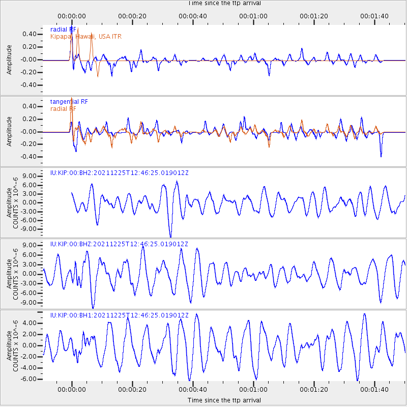
KIP Kipapa, Hawaii, USA - Earthquake Result Viewer
*The percent match for this event was below the threshold and hence no stack was calculated.
| Earthquake location: |
Tonga Islands |
| Earthquake latitude/longitude: |
-17.1/-173.6 |
| Earthquake time(UTC): |
2021/12/25 (359) 12:39:21 GMT |
| Earthquake Depth: |
105 km |
| Earthquake Magnitude: |
6.0 Mi |
| Earthquake Catalog/Contributor: |
NEIC PDE/pt |
|
| Network: |
IU Global Seismograph Network (GSN - IRIS/USGS) |
| Station: |
KIP Kipapa, Hawaii, USA |
| Lat/Lon: |
21.42 N/158.01 W |
| Elevation: |
70 m |
|
| Distance: |
41.2 deg |
| Az: |
22.356 deg |
| Baz: |
202.981 deg |
| Ray Param: |
$rayparam |
*The percent match for this event was below the threshold and hence was not used in the summary stack. |
|
| Radial Match: |
46.553127 % |
| Radial Bump: |
400 |
| Transverse Match: |
54.45954 % |
| Transverse Bump: |
396 |
| SOD ConfigId: |
26694651 |
| Insert Time: |
2022-01-08 12:51:19.386 +0000 |
| GWidth: |
2.5 |
| Max Bumps: |
400 |
| Tol: |
0.001 |
|
Signal To Noise
| Channel | StoN | STA | LTA |
| IU:KIP:00:BHZ:20211225T12:46:25.019012Z | 0.9108433 | 2.992965E-6 | 3.2859275E-6 |
| IU:KIP:00:BH1:20211225T12:46:25.019012Z | 0.571964 | 1.4203949E-6 | 2.4833641E-6 |
| IU:KIP:00:BH2:20211225T12:46:25.019012Z | 2.3947952 | 6.135028E-6 | 2.5618176E-6 |
| Arrivals |
| Ps | |
| PpPs | |
| PsPs/PpSs | |


