You are here: Home > Network List > UU - University of Utah Regional Network Stations List
> Station CCUT Cedar City, UT, USA > Earthquake Result Viewer
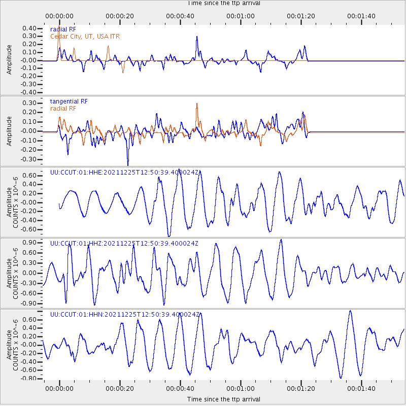
CCUT Cedar City, UT, USA - Earthquake Result Viewer
*The percent match for this event was below the threshold and hence no stack was calculated.
| Earthquake location: |
Tonga Islands |
| Earthquake latitude/longitude: |
-17.1/-173.6 |
| Earthquake time(UTC): |
2021/12/25 (359) 12:39:21 GMT |
| Earthquake Depth: |
105 km |
| Earthquake Magnitude: |
6.0 Mi |
| Earthquake Catalog/Contributor: |
NEIC PDE/pt |
|
| Network: |
UU University of Utah Regional Network |
| Station: |
CCUT Cedar City, UT, USA |
| Lat/Lon: |
37.55 N/113.36 W |
| Elevation: |
2127 m |
|
| Distance: |
78.5 deg |
| Az: |
44.772 deg |
| Baz: |
237.942 deg |
| Ray Param: |
$rayparam |
*The percent match for this event was below the threshold and hence was not used in the summary stack. |
|
| Radial Match: |
61.097073 % |
| Radial Bump: |
282 |
| Transverse Match: |
42.85098 % |
| Transverse Bump: |
390 |
| SOD ConfigId: |
26694651 |
| Insert Time: |
2022-01-08 12:59:26.774 +0000 |
| GWidth: |
2.5 |
| Max Bumps: |
400 |
| Tol: |
0.001 |
|
Signal To Noise
| Channel | StoN | STA | LTA |
| UU:CCUT:01:HHZ:20211225T12:50:39.400024Z | 2.4106894 | 4.6955574E-7 | 1.947807E-7 |
| UU:CCUT:01:HHN:20211225T12:50:39.400024Z | 0.60507447 | 1.3523953E-7 | 2.235089E-7 |
| UU:CCUT:01:HHE:20211225T12:50:39.400024Z | 1.9071107 | 3.4914595E-7 | 1.8307587E-7 |
| Arrivals |
| Ps | |
| PpPs | |
| PsPs/PpSs | |


