You are here: Home > Network List > CI - Caltech Regional Seismic Network Stations List
> Station DAN Danby, California, USA > Earthquake Result Viewer
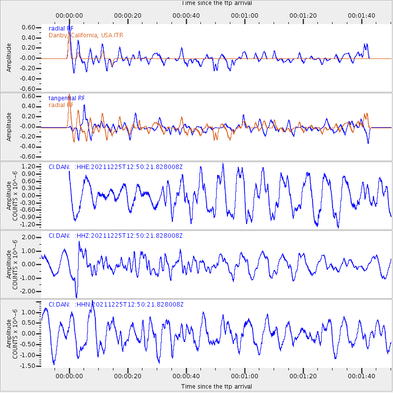
DAN Danby, California, USA - Earthquake Result Viewer
*The percent match for this event was below the threshold and hence no stack was calculated.
| Earthquake location: |
Tonga Islands |
| Earthquake latitude/longitude: |
-17.0/-173.5 |
| Earthquake time(UTC): |
2021/12/25 (359) 12:39:09 GMT |
| Earthquake Depth: |
8.6 km |
| Earthquake Magnitude: |
5.9 mb |
| Earthquake Catalog/Contributor: |
NEIC PDE/us |
|
| Network: |
CI Caltech Regional Seismic Network |
| Station: |
DAN Danby, California, USA |
| Lat/Lon: |
34.64 N/115.38 W |
| Elevation: |
398 m |
|
| Distance: |
75.4 deg |
| Az: |
46.352 deg |
| Baz: |
237.1 deg |
| Ray Param: |
$rayparam |
*The percent match for this event was below the threshold and hence was not used in the summary stack. |
|
| Radial Match: |
79.26112 % |
| Radial Bump: |
400 |
| Transverse Match: |
69.39065 % |
| Transverse Bump: |
400 |
| SOD ConfigId: |
26694651 |
| Insert Time: |
2022-01-08 13:07:58.855 +0000 |
| GWidth: |
2.5 |
| Max Bumps: |
400 |
| Tol: |
0.001 |
|
Signal To Noise
| Channel | StoN | STA | LTA |
| CI:DAN: :HHZ:20211225T12:50:21.828008Z | 2.6680803 | 1.174208E-6 | 4.400947E-7 |
| CI:DAN: :HHN:20211225T12:50:21.828008Z | 1.083706 | 6.893955E-7 | 6.3614624E-7 |
| CI:DAN: :HHE:20211225T12:50:21.828008Z | 0.83386695 | 3.5487147E-7 | 4.255733E-7 |
| Arrivals |
| Ps | |
| PpPs | |
| PsPs/PpSs | |


