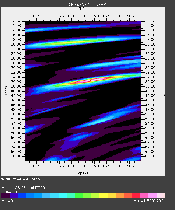
SNP27 SNP27 - Earthquake Result Viewer

Earthquake location: Near East Coast Of Honshu, Japan
Earthquake latitude/longitude: 38.1/142.1
Earthquake time(UTC): 2005/12/02 (336) 13:13:09 GMT
Earthquake Depth: 29 km
Earthquake Magnitude: 6.1 MB, 6.3 MS, 6.5 MW, 6.4 MW
Earthquake Catalog/Contributor: WHDF/NEIC
Network: XE Sierra Nevada EarthScope Project- EarthScope Flex Array
Station: SNP27 SNP27
Lat/Lon: 37.66 N/118.35 W
Elevation: 1739 m
Distance: 74.3 deg
Az: 54.38 deg
Baz: 306.078 deg
Ray Param: 0.052367404
Estimated Moho Depth: 35.25 km
Estimated Crust Vp/Vs: 1.88
Assumed Crust Vp: 6.291 km/s
Estimated Crust Vs: 3.346 km/s
Estimated Crust Poisson's Ratio: 0.30
Radial Match: 84.432465 %
Radial Bump: 400
Transverse Match: 75.215965 %
Transverse Bump: 400
SOD ConfigId: 268666
Insert Time: 2010-03-09 15:18:27.703 +0000
GWidth: 2.5
Max Bumps: 400
Tol: 0.001

Signal To Noise

ChannelStoNSTALTA
XE:SNP27:01:BHZ:20051202T13:24:13.170024Z1.9279933.7104803E-71.9245299E-7
XE:SNP27:01:BHN:20051202T13:24:13.170024Z1.15251491.8977964E-71.6466566E-7
XE:SNP27:01:BHE:20051202T13:24:13.170024Z0.990216431.3089041E-71.3218364E-7
Arrivals
Ps5.1 SECOND
PpPs16 SECOND
PsPs/PpSs21 SECOND