You are here: Home > Network List > CI - Caltech Regional Seismic Network Stations List
> Station GSC Goldstone, Goldstone Lake, CA, USA > Earthquake Result Viewer
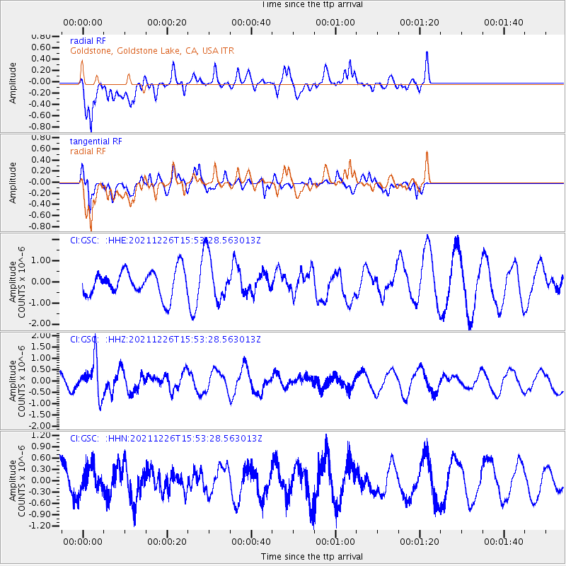
GSC Goldstone, Goldstone Lake, CA, USA - Earthquake Result Viewer
*The percent match for this event was below the threshold and hence no stack was calculated.
| Earthquake location: |
Fiji Islands Region |
| Earthquake latitude/longitude: |
-18.1/-179.4 |
| Earthquake time(UTC): |
2021/12/26 (360) 15:42:56 GMT |
| Earthquake Depth: |
627 km |
| Earthquake Magnitude: |
6.1 mww |
| Earthquake Catalog/Contributor: |
NEIC PDE/us |
|
| Network: |
CI Caltech Regional Seismic Network |
| Station: |
GSC Goldstone, Goldstone Lake, CA, USA |
| Lat/Lon: |
35.30 N/116.81 W |
| Elevation: |
1000 m |
|
| Distance: |
79.6 deg |
| Az: |
47.57 deg |
| Baz: |
239.135 deg |
| Ray Param: |
$rayparam |
*The percent match for this event was below the threshold and hence was not used in the summary stack. |
|
| Radial Match: |
53.666954 % |
| Radial Bump: |
400 |
| Transverse Match: |
74.90916 % |
| Transverse Bump: |
355 |
| SOD ConfigId: |
26694651 |
| Insert Time: |
2022-01-09 15:53:49.354 +0000 |
| GWidth: |
2.5 |
| Max Bumps: |
400 |
| Tol: |
0.001 |
|
Signal To Noise
| Channel | StoN | STA | LTA |
| CI:GSC: :HHZ:20211226T15:53:28.563013Z | 2.9167933 | 7.987595E-7 | 2.738485E-7 |
| CI:GSC: :HHN:20211226T15:53:28.563013Z | 0.56773996 | 3.3753093E-7 | 5.945168E-7 |
| CI:GSC: :HHE:20211226T15:53:28.563013Z | 1.7887039 | 1.076872E-6 | 6.0204036E-7 |
| Arrivals |
| Ps | |
| PpPs | |
| PsPs/PpSs | |


