You are here: Home > Network List > IW - Intermountain West Stations List
> Station MOOW Moose Ponds, Wyoming, USA > Earthquake Result Viewer
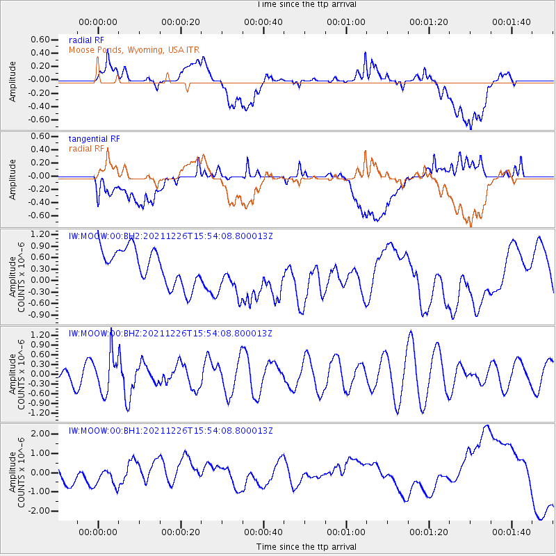
MOOW Moose Ponds, Wyoming, USA - Earthquake Result Viewer
*The percent match for this event was below the threshold and hence no stack was calculated.
| Earthquake location: |
Fiji Islands Region |
| Earthquake latitude/longitude: |
-18.1/-179.4 |
| Earthquake time(UTC): |
2021/12/26 (360) 15:42:56 GMT |
| Earthquake Depth: |
627 km |
| Earthquake Magnitude: |
6.1 mww |
| Earthquake Catalog/Contributor: |
NEIC PDE/us |
|
| Network: |
IW Intermountain West |
| Station: |
MOOW Moose Ponds, Wyoming, USA |
| Lat/Lon: |
43.75 N/110.74 W |
| Elevation: |
2128 m |
|
| Distance: |
87.8 deg |
| Az: |
42.479 deg |
| Baz: |
242.426 deg |
| Ray Param: |
$rayparam |
*The percent match for this event was below the threshold and hence was not used in the summary stack. |
|
| Radial Match: |
17.986696 % |
| Radial Bump: |
400 |
| Transverse Match: |
21.452663 % |
| Transverse Bump: |
400 |
| SOD ConfigId: |
26694651 |
| Insert Time: |
2022-01-09 15:57:29.375 +0000 |
| GWidth: |
2.5 |
| Max Bumps: |
400 |
| Tol: |
0.001 |
|
Signal To Noise
| Channel | StoN | STA | LTA |
| IW:MOOW:00:BHZ:20211226T15:54:08.800013Z | 1.5331895 | 5.992256E-7 | 3.9083594E-7 |
| IW:MOOW:00:BH1:20211226T15:54:08.800013Z | 0.60087174 | 3.8586228E-7 | 6.421708E-7 |
| IW:MOOW:00:BH2:20211226T15:54:08.800013Z | 1.2292982 | 5.7180125E-7 | 4.6514444E-7 |
| Arrivals |
| Ps | |
| PpPs | |
| PsPs/PpSs | |


