You are here: Home > Network List > TX - Texas Seismological Network Stations List
> Station SNAG San Augustine > Earthquake Result Viewer
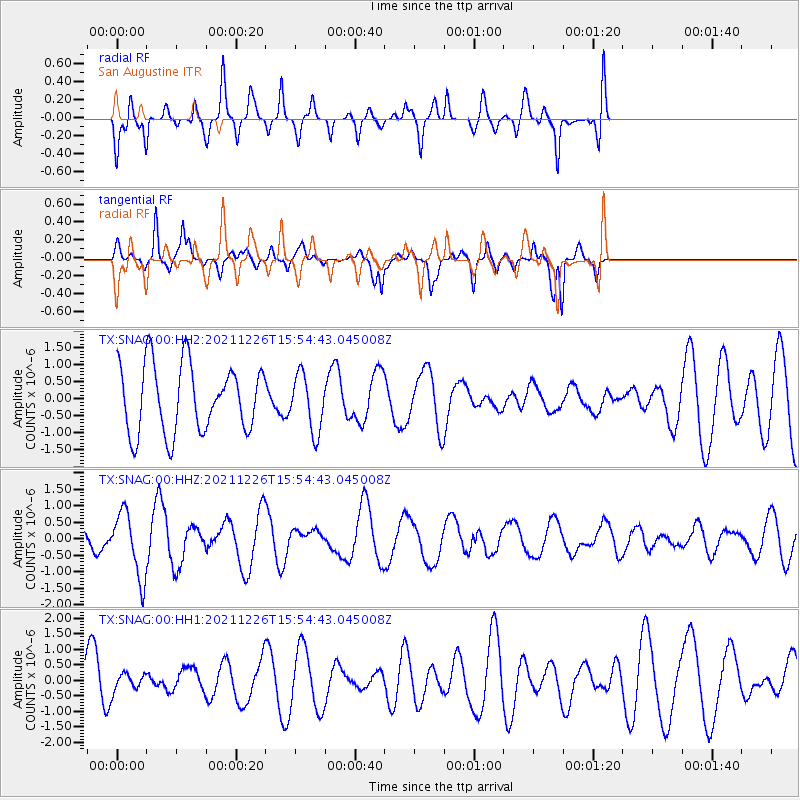
SNAG San Augustine - Earthquake Result Viewer
*The percent match for this event was below the threshold and hence no stack was calculated.
| Earthquake location: |
Fiji Islands Region |
| Earthquake latitude/longitude: |
-18.1/-179.4 |
| Earthquake time(UTC): |
2021/12/26 (360) 15:42:56 GMT |
| Earthquake Depth: |
627 km |
| Earthquake Magnitude: |
6.1 mww |
| Earthquake Catalog/Contributor: |
NEIC PDE/us |
|
| Network: |
TX Texas Seismological Network |
| Station: |
SNAG San Augustine |
| Lat/Lon: |
31.52 N/94.18 W |
| Elevation: |
84 m |
|
| Distance: |
95.3 deg |
| Az: |
58.722 deg |
| Baz: |
252.163 deg |
| Ray Param: |
$rayparam |
*The percent match for this event was below the threshold and hence was not used in the summary stack. |
|
| Radial Match: |
48.01876 % |
| Radial Bump: |
388 |
| Transverse Match: |
54.532894 % |
| Transverse Bump: |
363 |
| SOD ConfigId: |
26694651 |
| Insert Time: |
2022-01-09 16:02:54.850 +0000 |
| GWidth: |
2.5 |
| Max Bumps: |
400 |
| Tol: |
0.001 |
|
Signal To Noise
| Channel | StoN | STA | LTA |
| TX:SNAG:00:HHZ:20211226T15:54:43.045008Z | 3.0715394 | 9.891567E-7 | 3.2203937E-7 |
| TX:SNAG:00:HH1:20211226T15:54:43.045008Z | 0.3738456 | 2.7802162E-7 | 7.436803E-7 |
| TX:SNAG:00:HH2:20211226T15:54:43.045008Z | 0.83422 | 8.288629E-7 | 9.935783E-7 |
| Arrivals |
| Ps | |
| PpPs | |
| PsPs/PpSs | |


