You are here: Home > Network List > IU - Global Seismograph Network (GSN - IRIS/USGS) Stations List
> Station RSSD Black Hills, South Dakota, USA > Earthquake Result Viewer
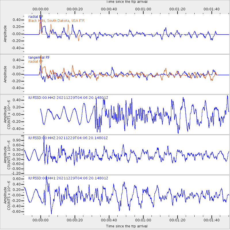
RSSD Black Hills, South Dakota, USA - Earthquake Result Viewer
*The percent match for this event was below the threshold and hence no stack was calculated.
| Earthquake location: |
Near Islands, Aleutian Islands |
| Earthquake latitude/longitude: |
54.7/170.6 |
| Earthquake time(UTC): |
2021/12/29 (363) 03:57:35 GMT |
| Earthquake Depth: |
26 km |
| Earthquake Magnitude: |
5.6 Mi |
| Earthquake Catalog/Contributor: |
NEIC PDE/at |
|
| Network: |
IU Global Seismograph Network (GSN - IRIS/USGS) |
| Station: |
RSSD Black Hills, South Dakota, USA |
| Lat/Lon: |
44.12 N/104.04 W |
| Elevation: |
2090 m |
|
| Distance: |
53.2 deg |
| Az: |
63.677 deg |
| Baz: |
313.706 deg |
| Ray Param: |
$rayparam |
*The percent match for this event was below the threshold and hence was not used in the summary stack. |
|
| Radial Match: |
65.36529 % |
| Radial Bump: |
400 |
| Transverse Match: |
43.002407 % |
| Transverse Bump: |
400 |
| SOD ConfigId: |
26694651 |
| Insert Time: |
2022-01-12 04:08:40.745 +0000 |
| GWidth: |
2.5 |
| Max Bumps: |
400 |
| Tol: |
0.001 |
|
Signal To Noise
| Channel | StoN | STA | LTA |
| IU:RSSD:00:HHZ:20211229T04:06:20.14801Z | 2.3650098 | 3.770523E-7 | 1.5942949E-7 |
| IU:RSSD:00:HH1:20211229T04:06:20.14801Z | 2.3557034 | 3.037913E-7 | 1.2895991E-7 |
| IU:RSSD:00:HH2:20211229T04:06:20.14801Z | 1.7827692 | 2.4034807E-7 | 1.3481726E-7 |
| Arrivals |
| Ps | |
| PpPs | |
| PsPs/PpSs | |


